

Greece (7341 Subjects)
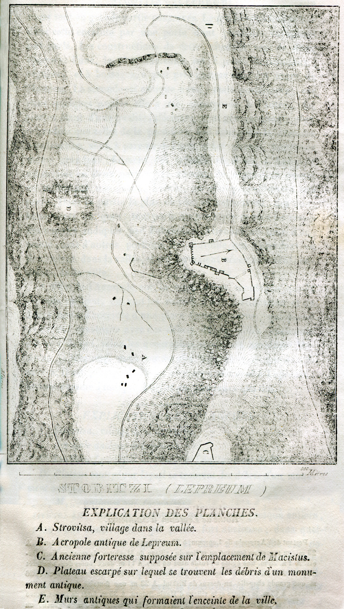
Topographical map of Lepreon, ancient city in southern Triphylia in Elis.
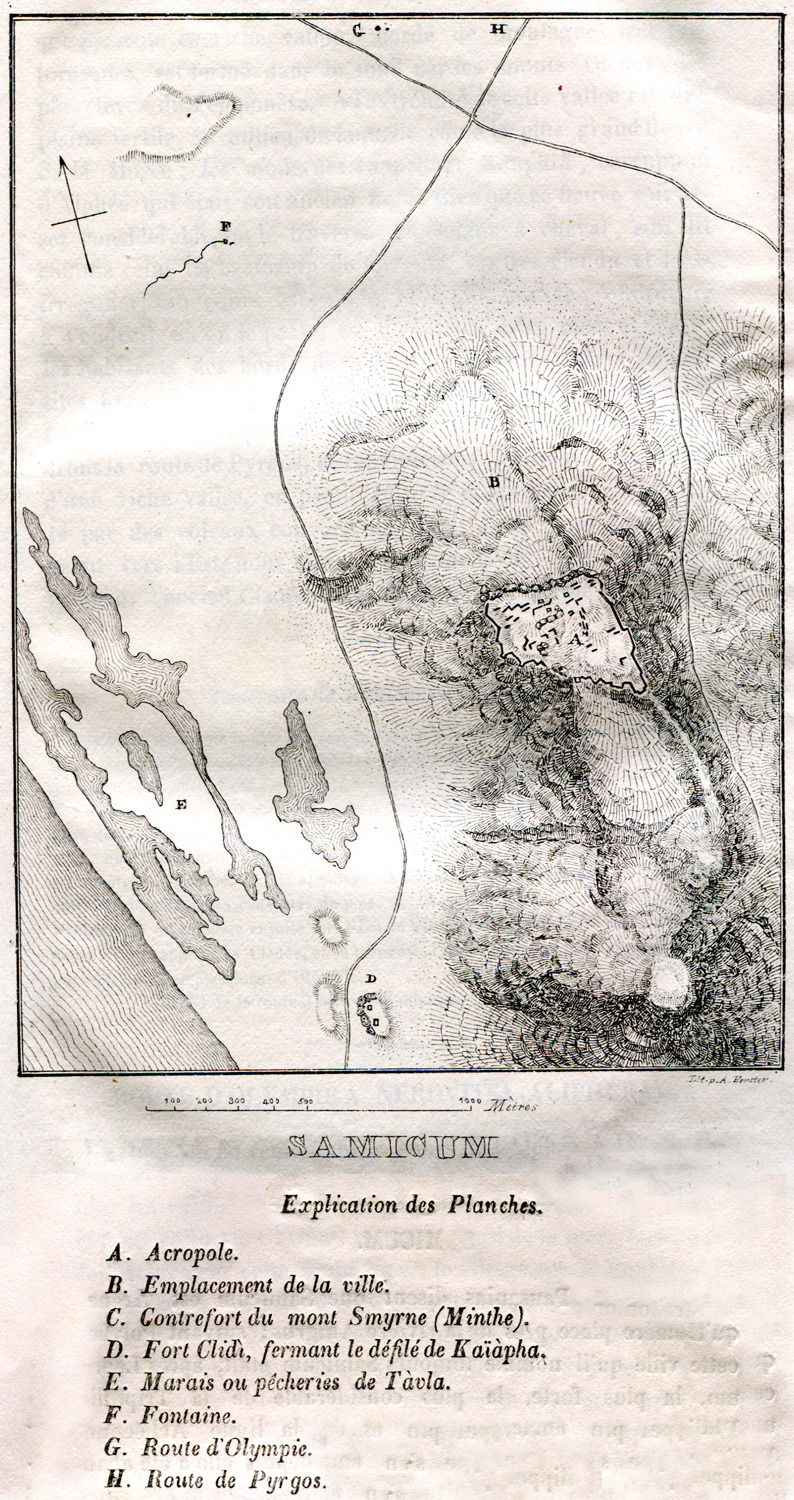
Topographical map of Samicon, the area of the ancient city called Makistos, Arene and Samia, Samicon or Samos.
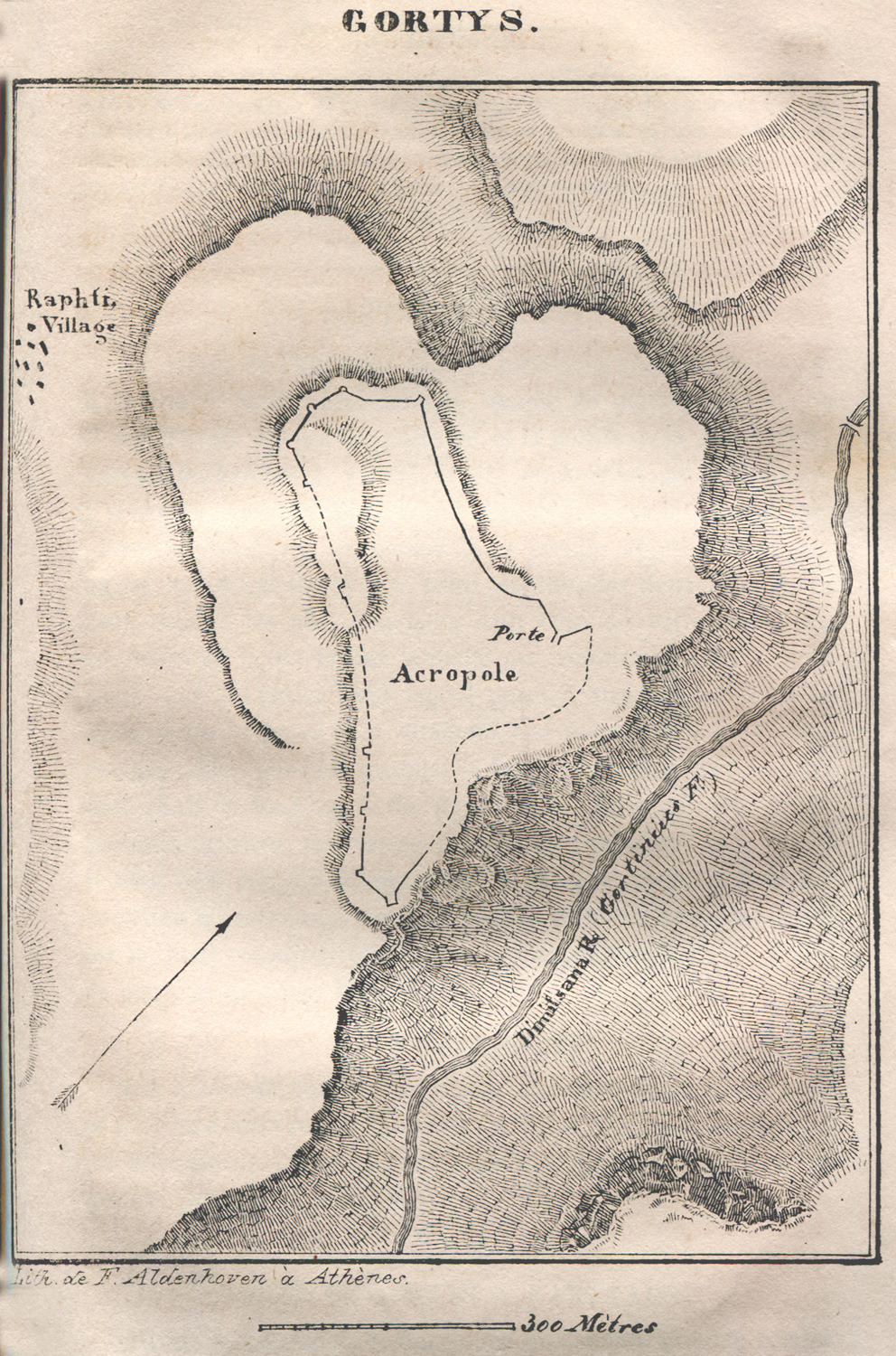
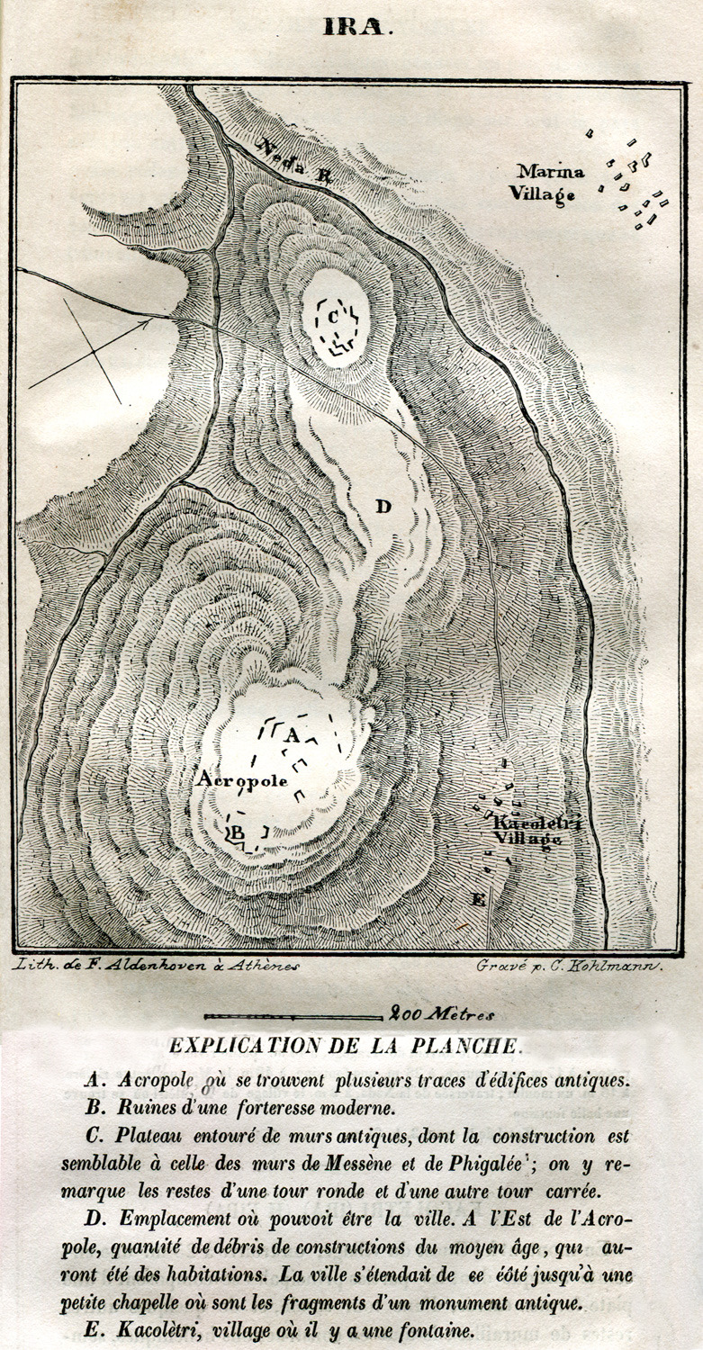
Topographical map of Gortyna in Arcadia.
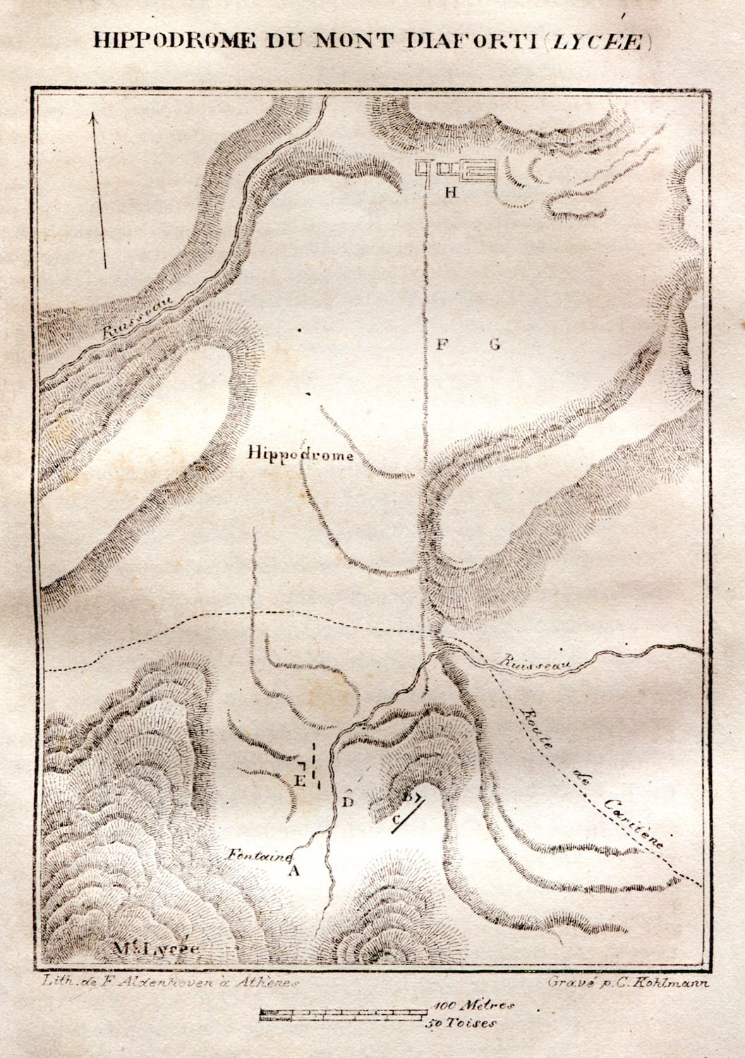
Topographical map of Mount Lykaion in Arcadia, showing the site of the Hippodrome where the Lycaean Games took place.
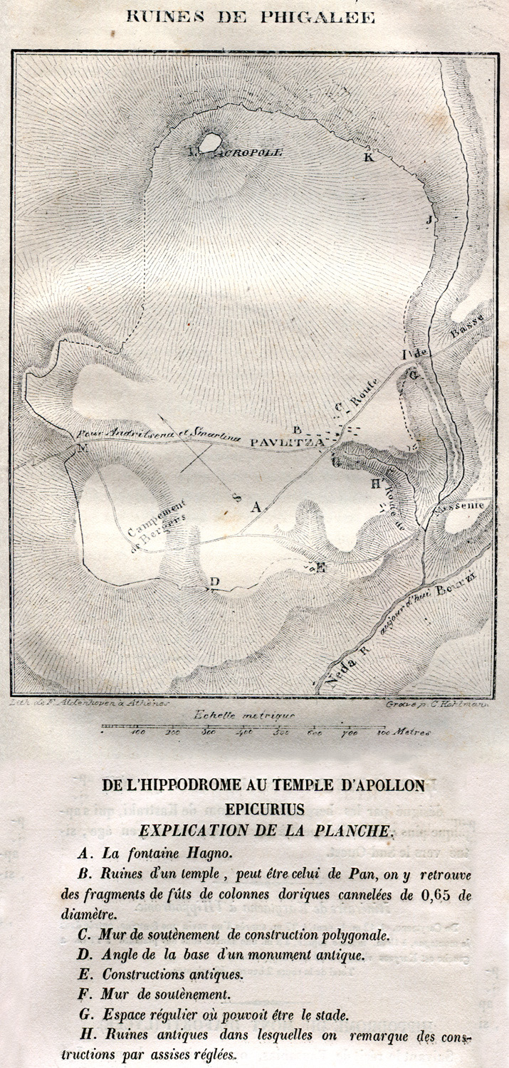
Topographical map of ancient Phigaleia in Arcadia.
Topographical map of Alipheira, ancient city in Elis.
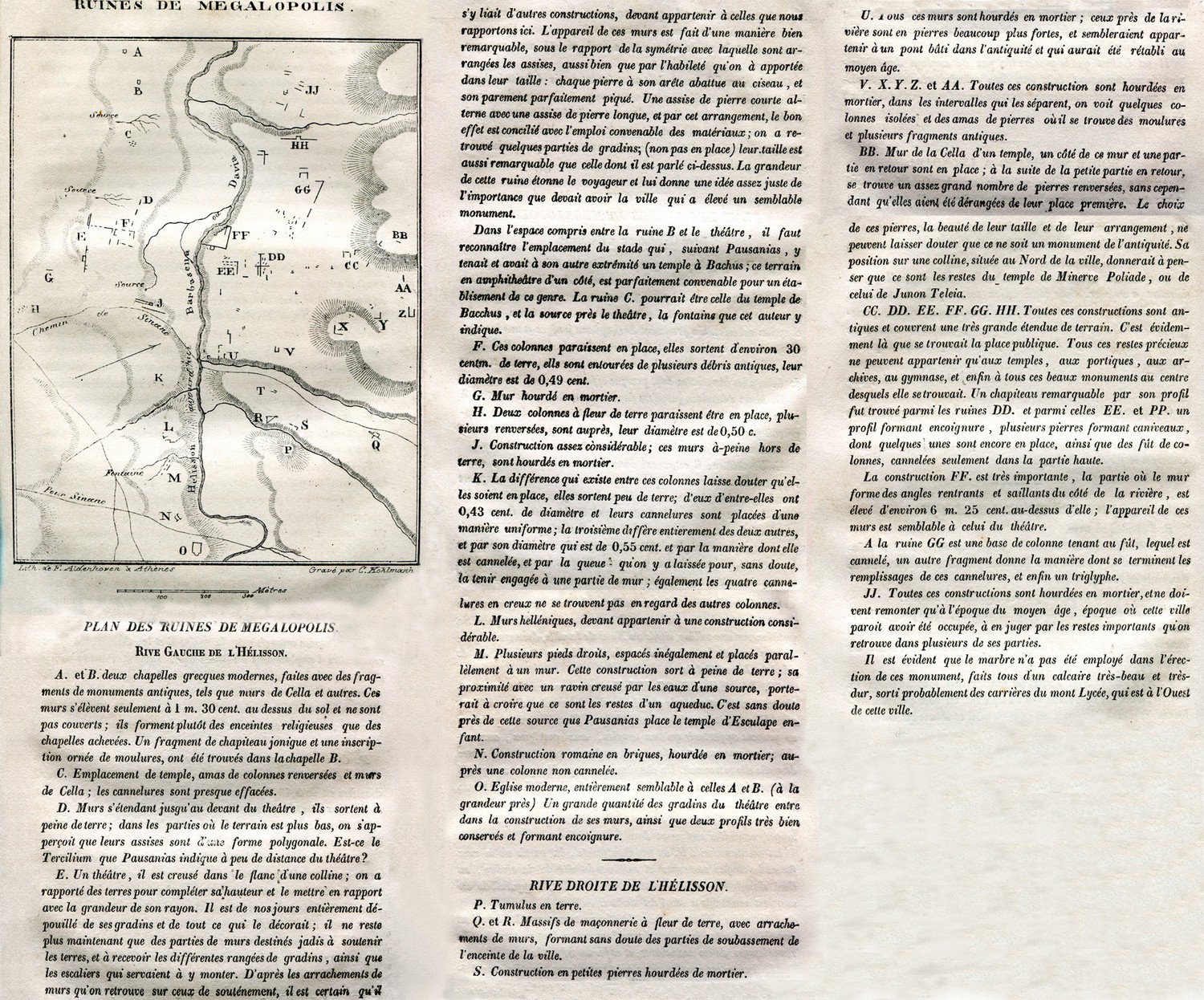
Topographical map of Megalopolis. .
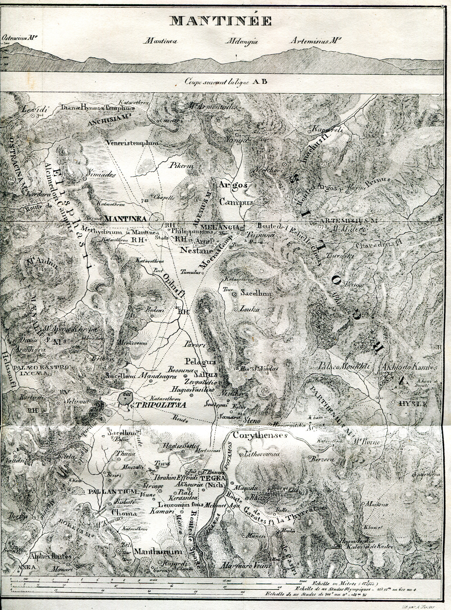
Topographical map of Mantineia, province of Arcadia.
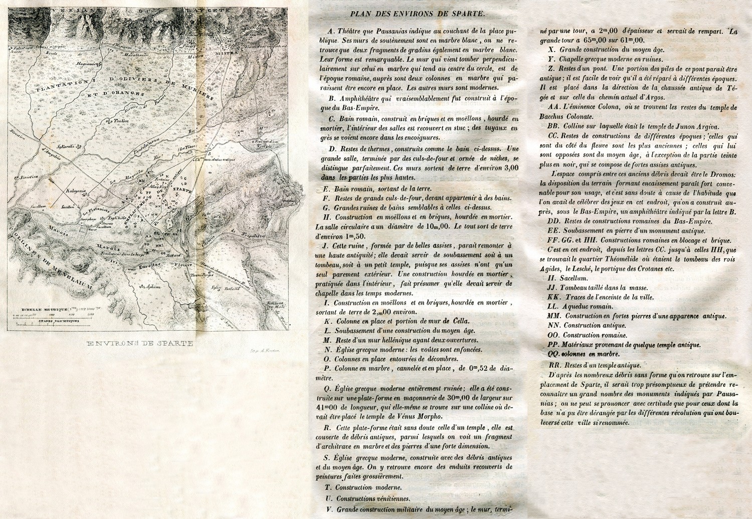
Topographical map of the area surrounding Sparta.
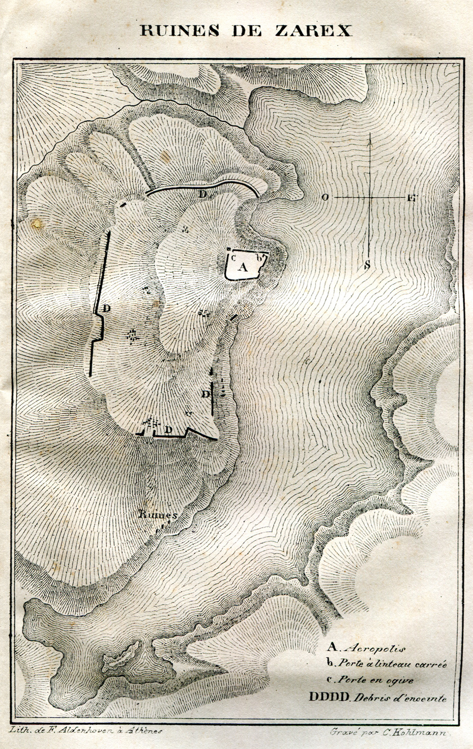
Topographical map of the ancient city Zarax (Zarakas) at the bay of Gerakas in Lakonia.
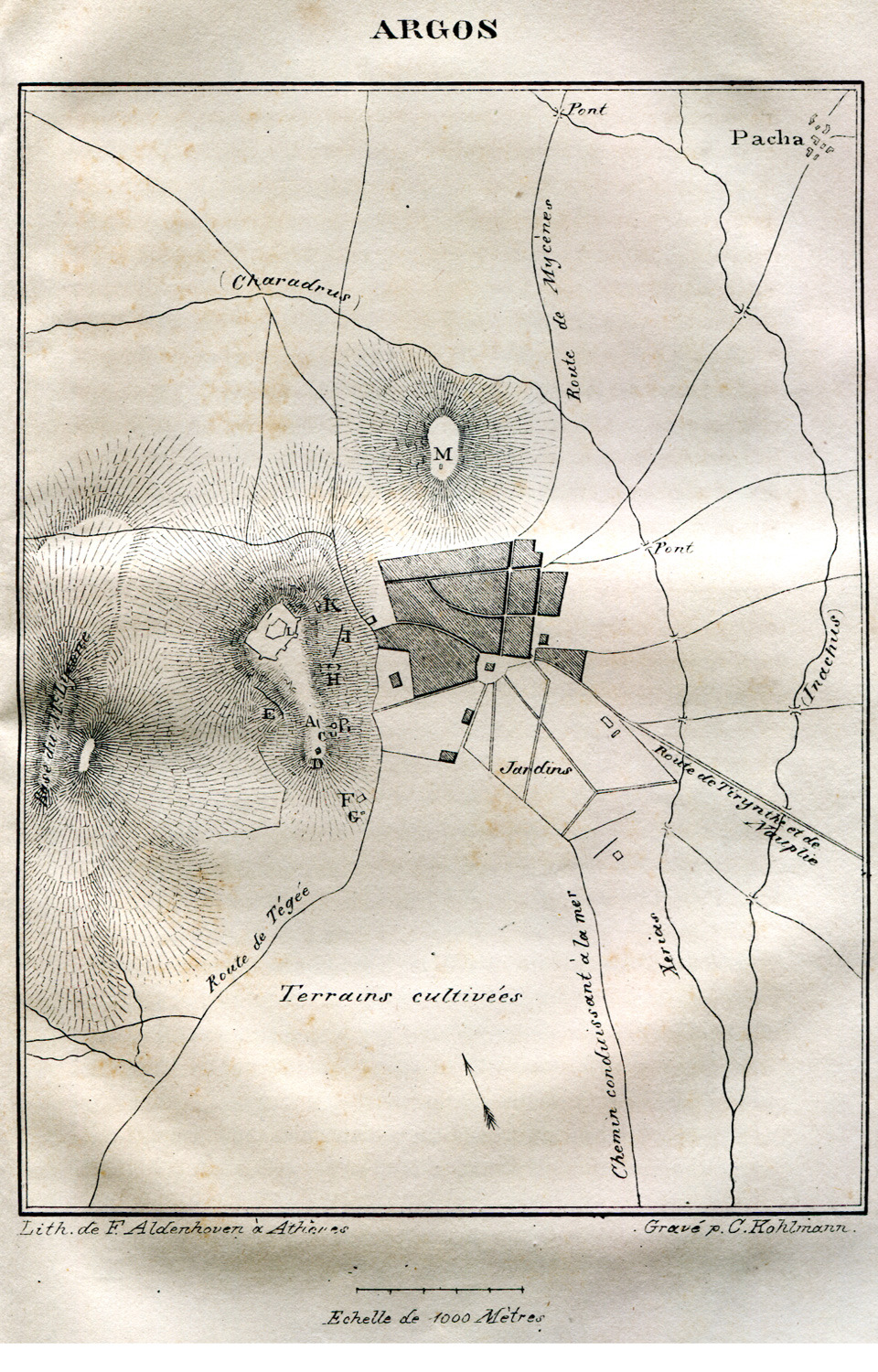
Topographical map of Argos.
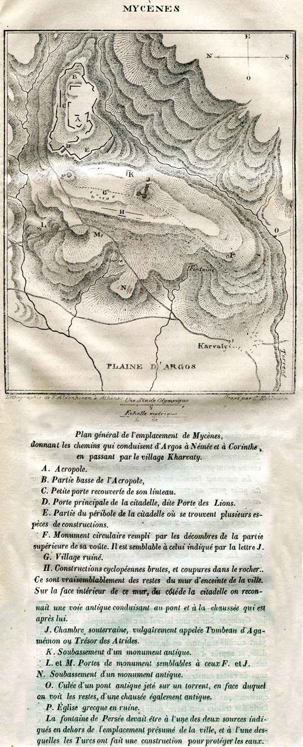
Topographical map of Mycenae.
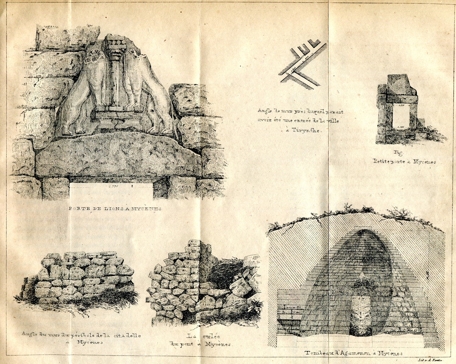
Details from Mycenae.
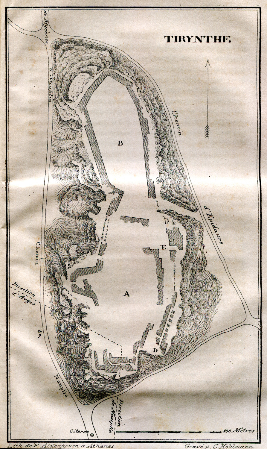
Topographical map of ancient Tiryns.
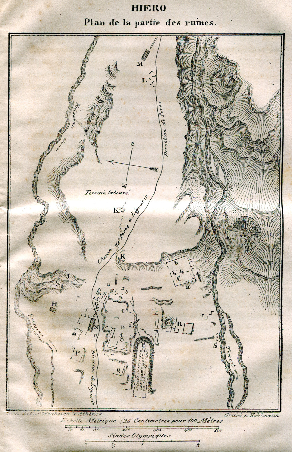
Topographical map of the Asclepeion in Epidaurus.
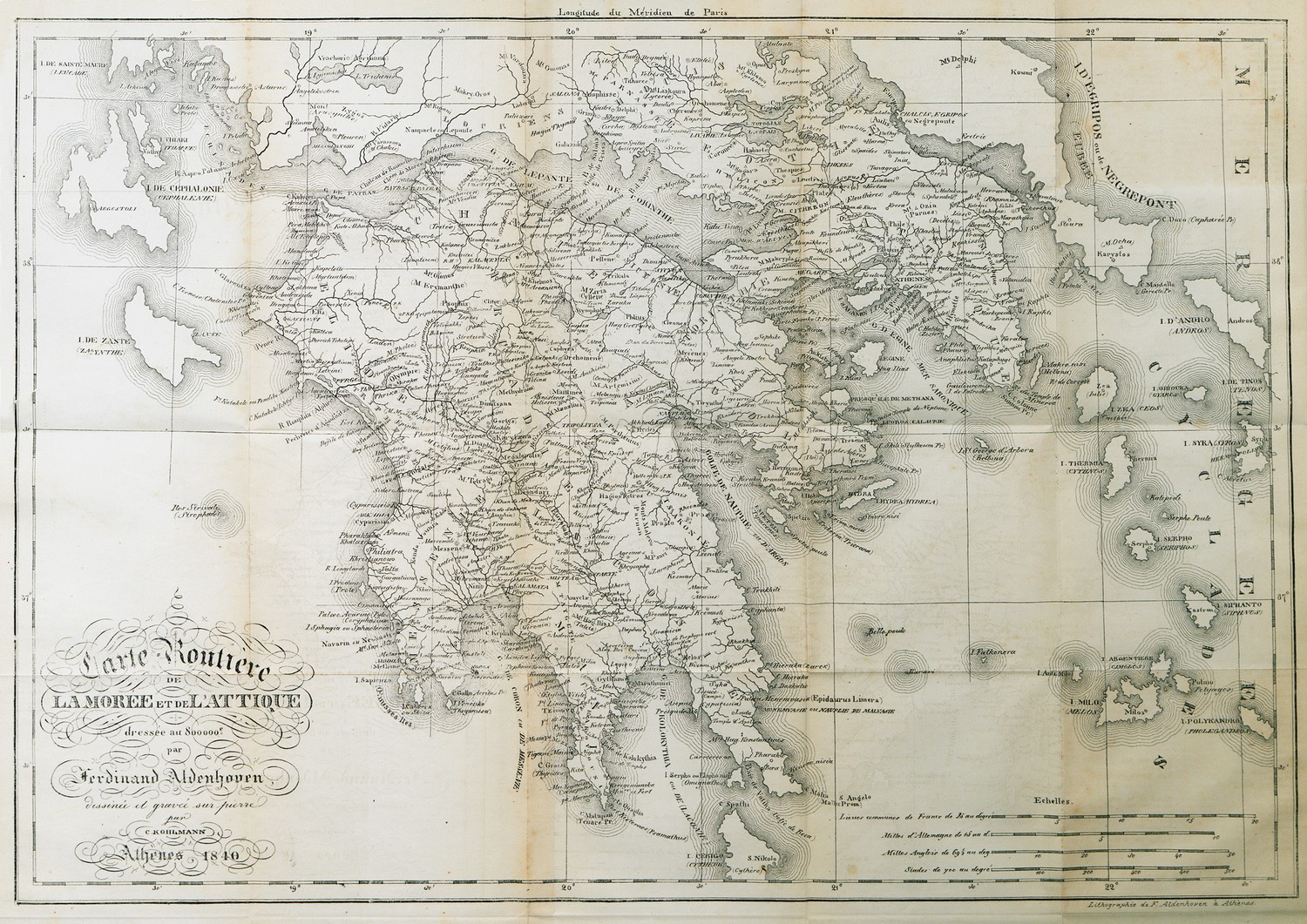
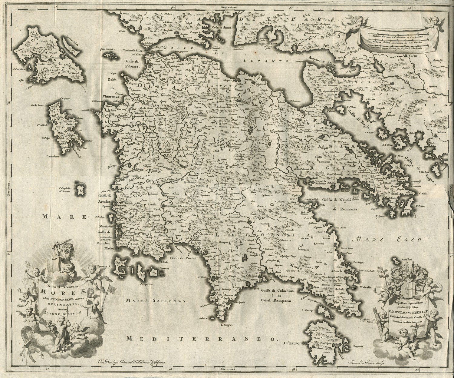
Map of Attica and the Peloponnese.
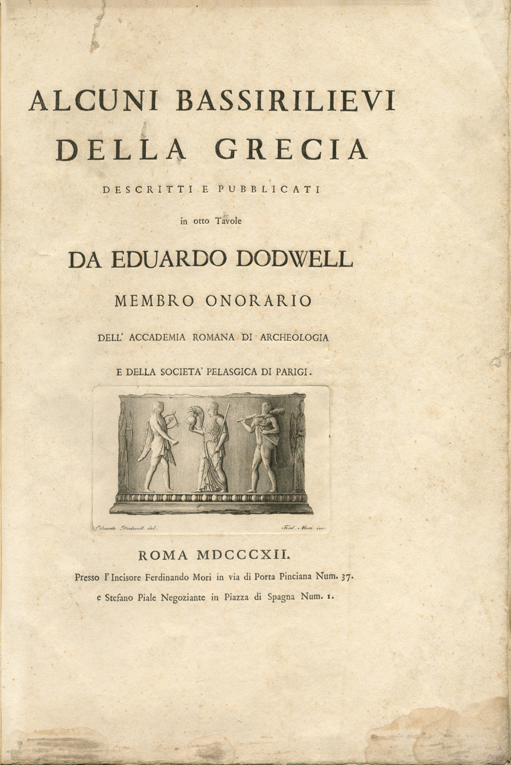
Title page. Ancient relief, most possibly from the mouth of a well (puteale), depicting Heracles, Athena, Apollo and Artemis.
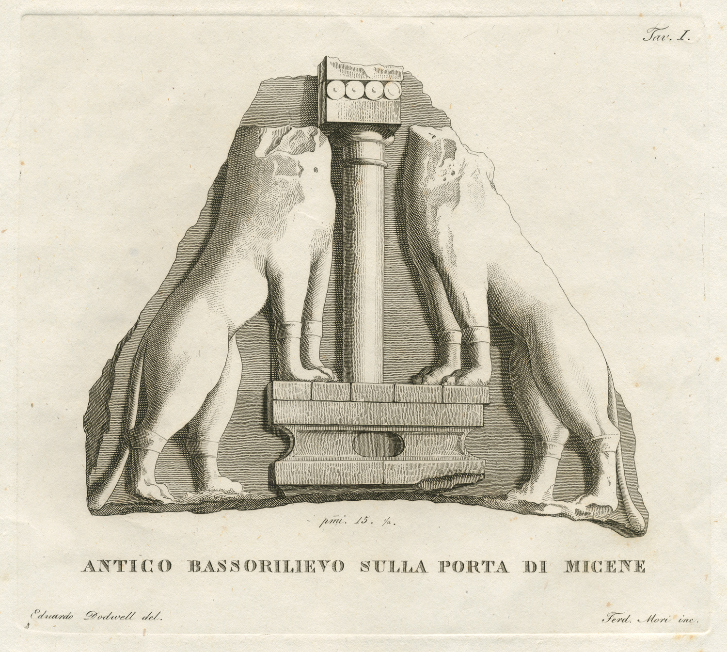
The relief from the Lions' Gate in the Acropolis of Mycenae.
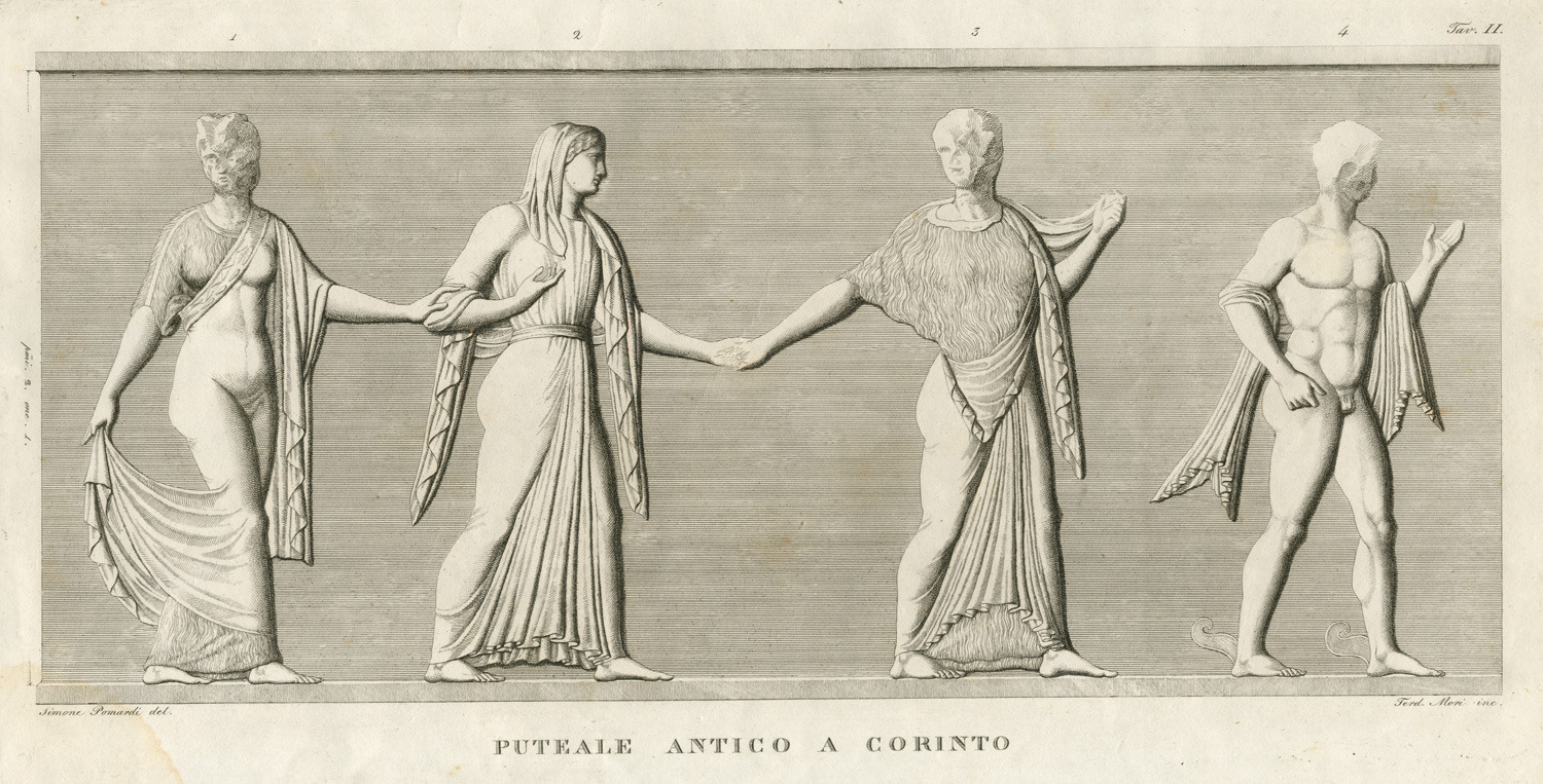
Relief from the mouth of a well (puteale), from Ancient Corinth.
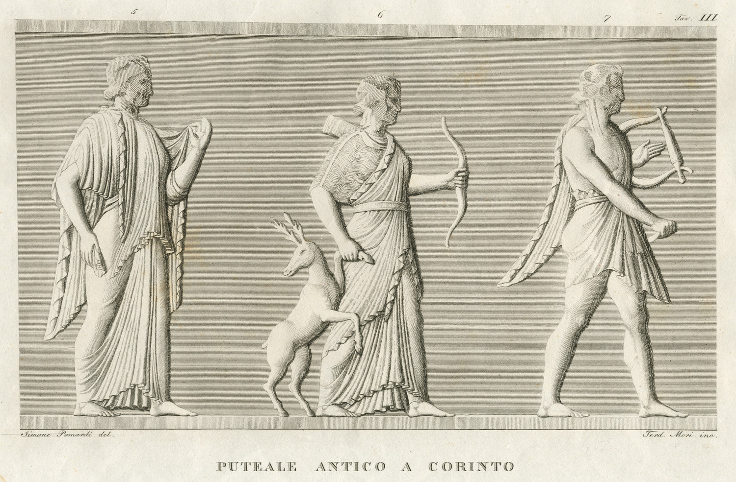
Relief from the mouth of a well (puteale), from Ancient Corinth, depicting Artemis and Apollo.
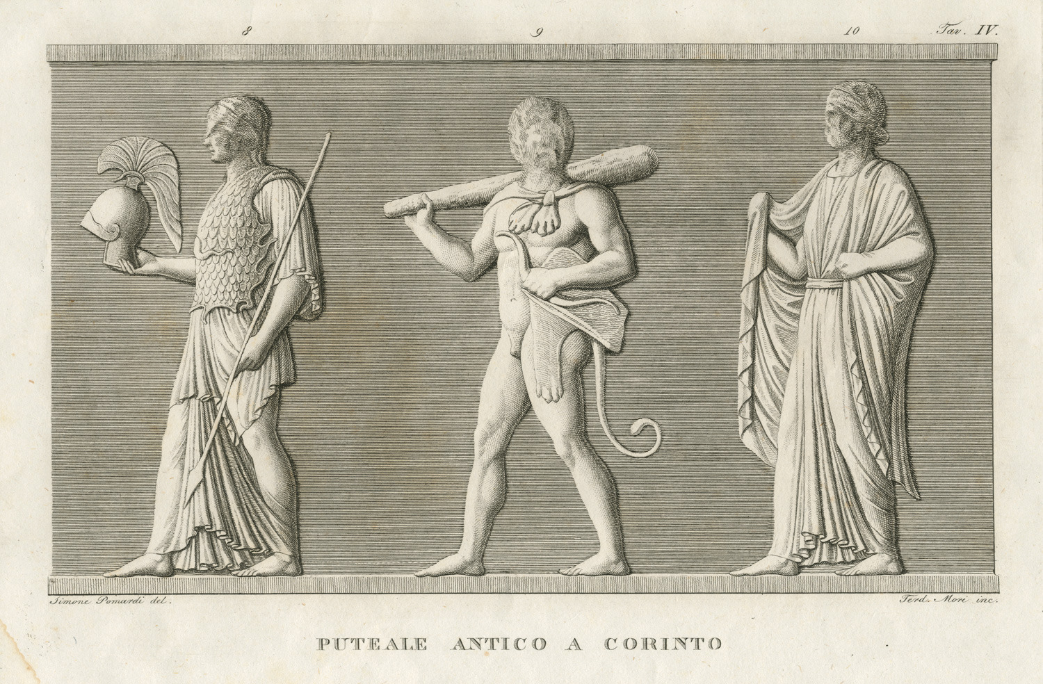
Relief from the mouth of a well (puteale), from Ancient Corinth, depicting Athena and Heracles.
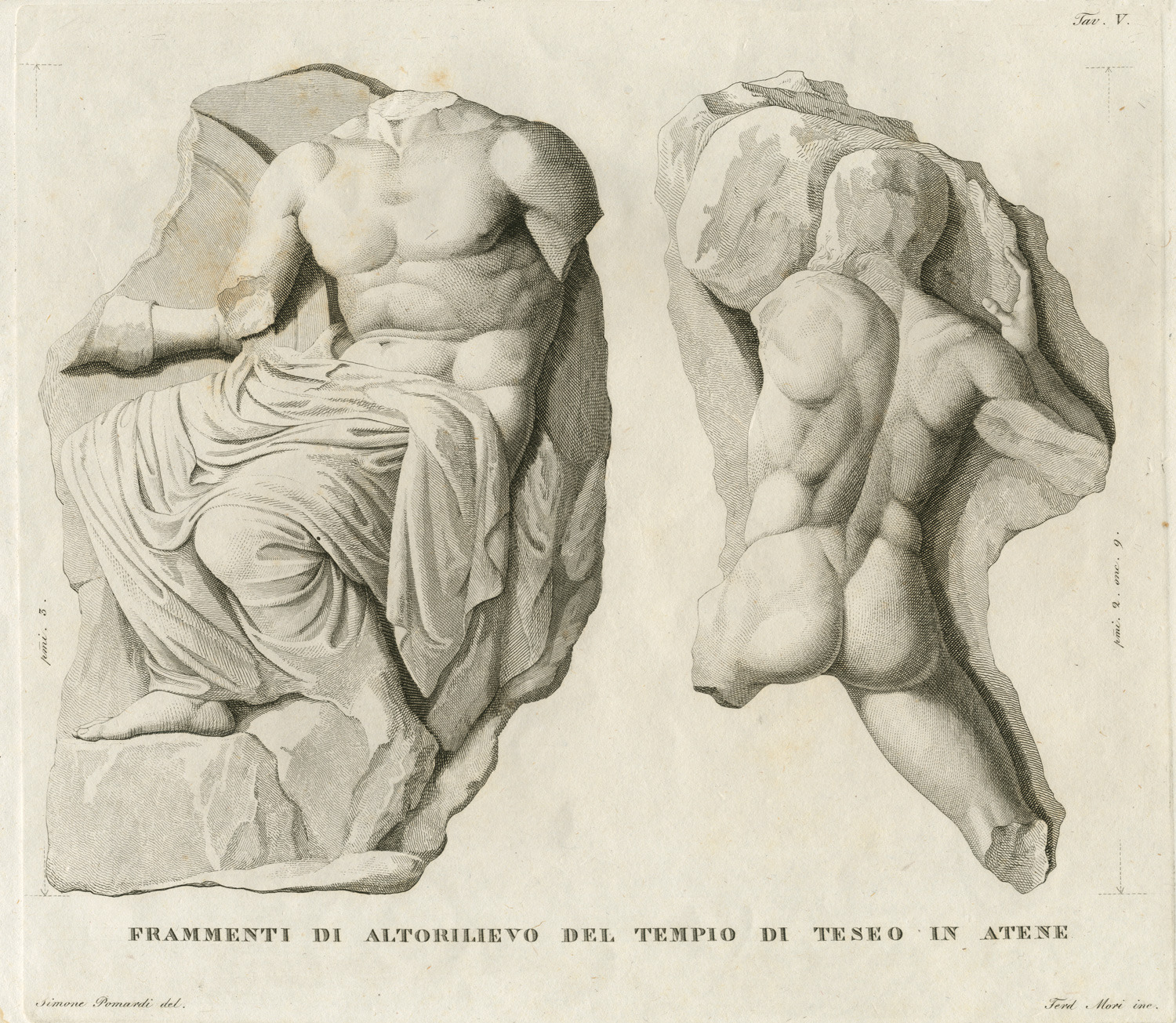
Fragments of the metopes of the Temple of Hephaestus in Athens.
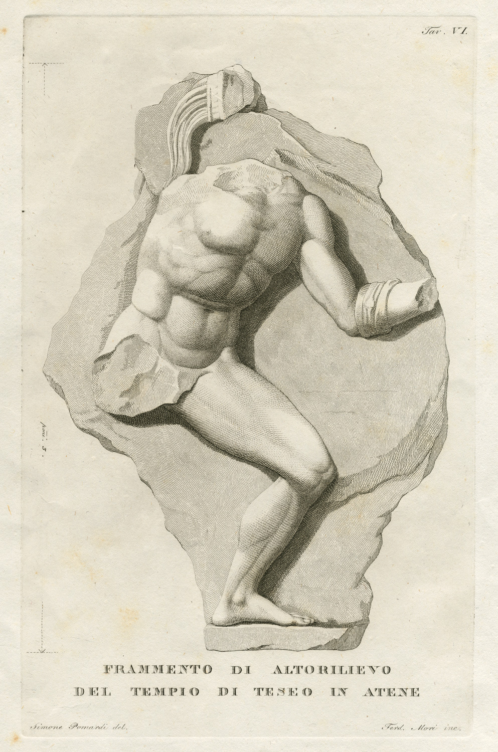
Fragments of the metopes of the Temple of Hephaestus in Athens.
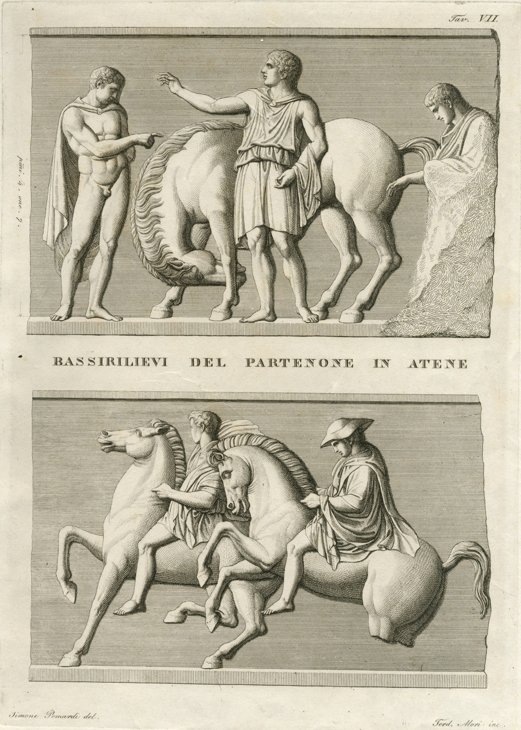
Fragments of the Parthenon frieze.

Fragment of an ancient relief.
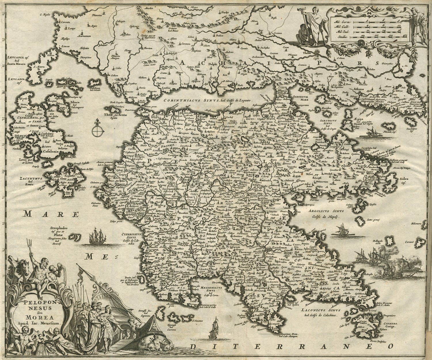
Map of Peloponnese with the Ionian islands and part of Central Greece.
Map of Peloponnese with the Ionian islands and part of Central Greece.
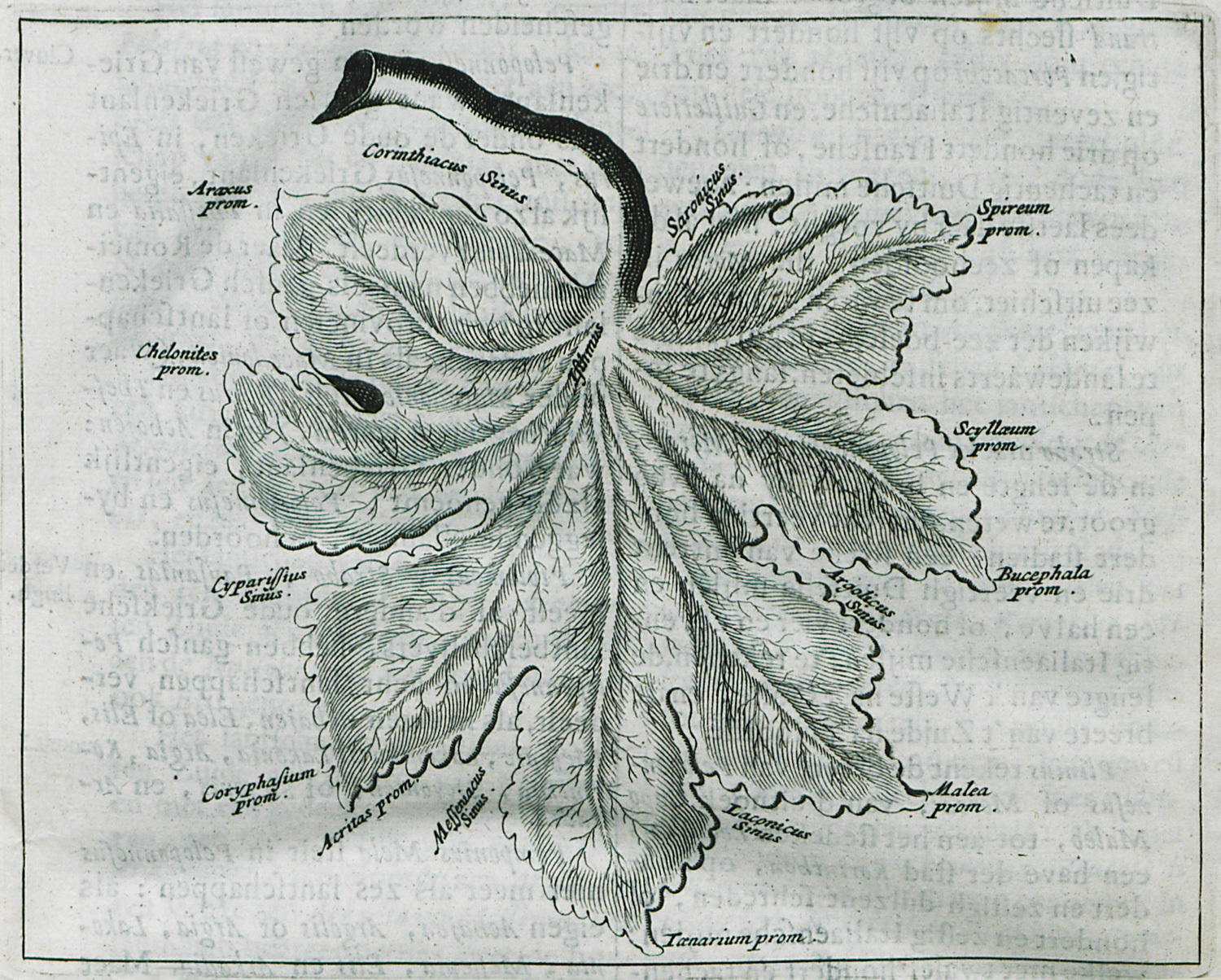
Representation of Peloponnese as a leaf. The most important gulf and capes are noted.
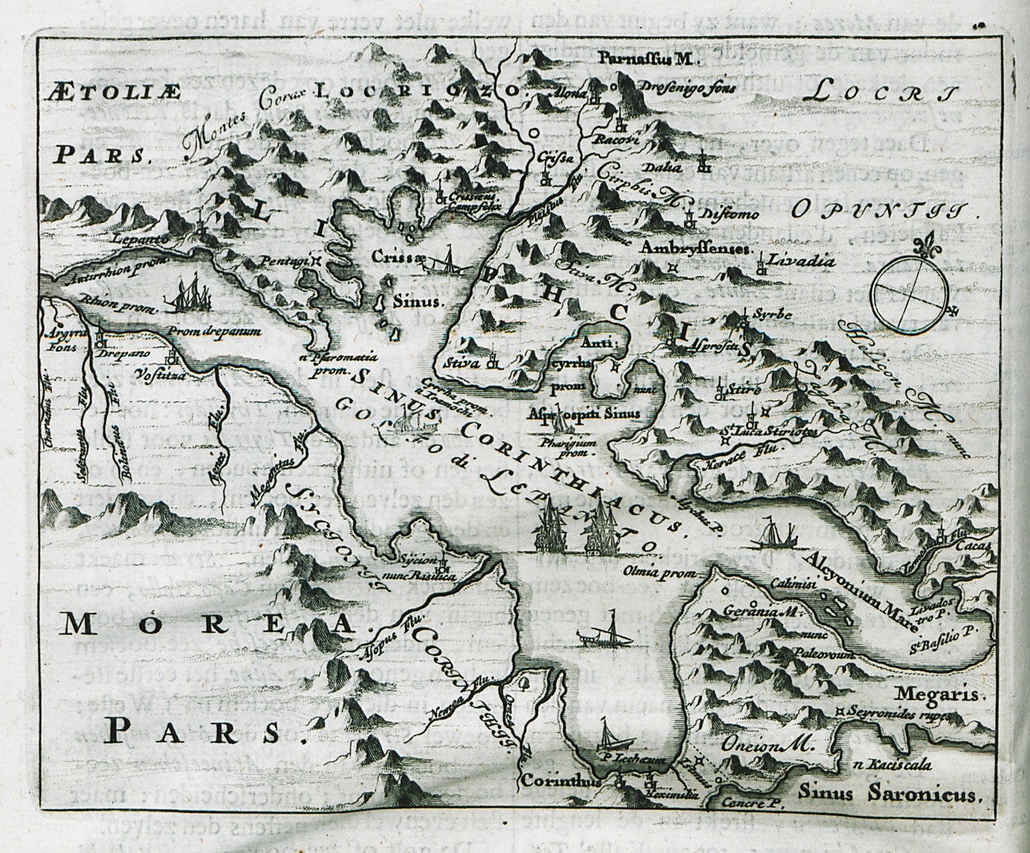
Map of the Corinthian Gulf.
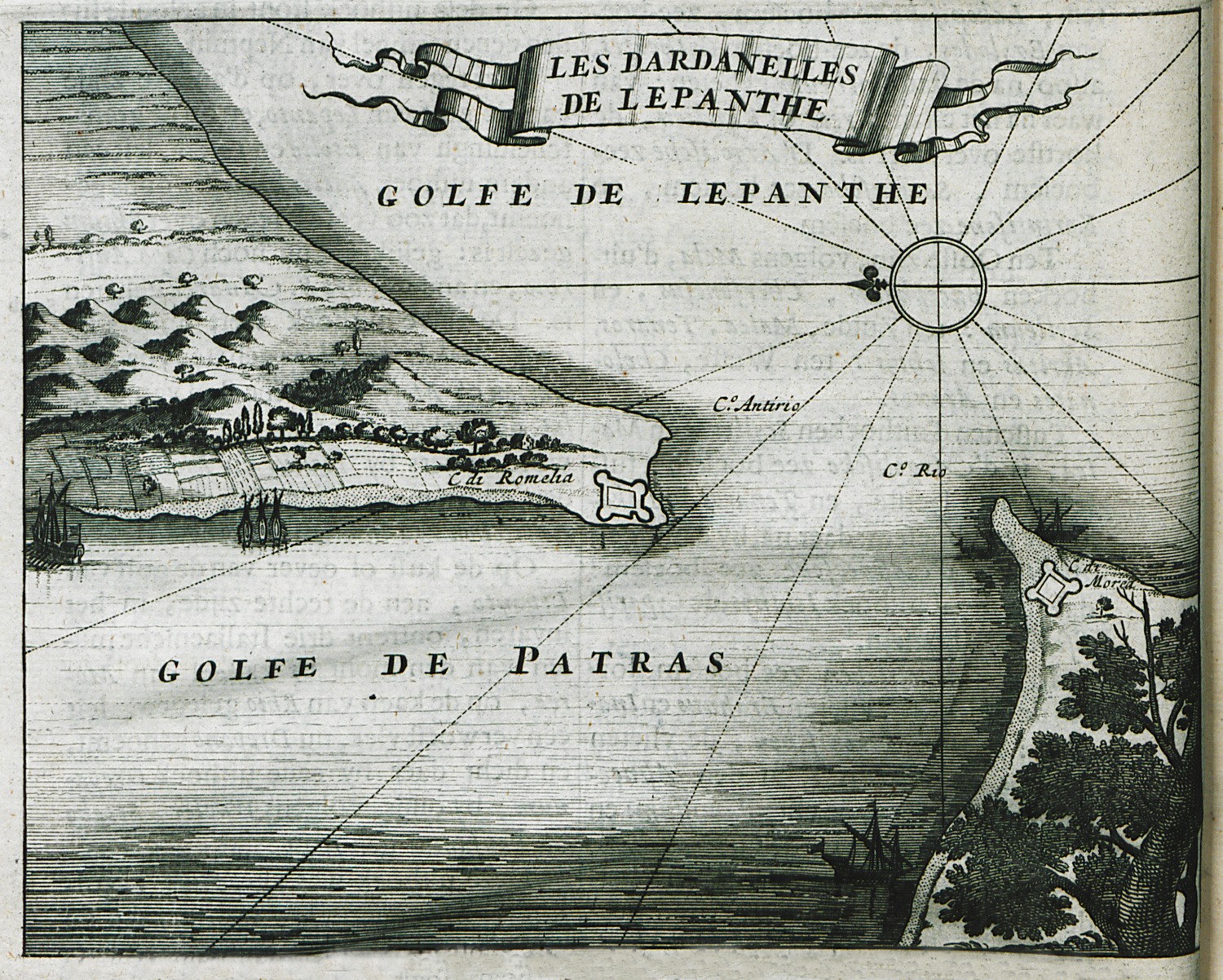
Map of the strait Rio-Antirio