

Greece (7341 Subjects)
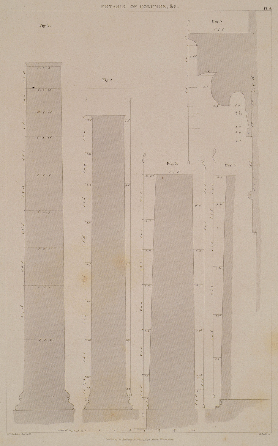
The entasis of various columns. Fig. 1. Entasis of the columns of the North Portico of the Erechtheion. Fig. 2: Entasis of the columns of the East Portico of that Temple. Fig. 3: Entasis of the columns of the Temple of Hephaestus (Thiseion). Fig. 4: Entasis of the columns of the Parthenon. Fig. 5: Section of the capital of the centre anta of the Choragic Monument of Thrasyllus.
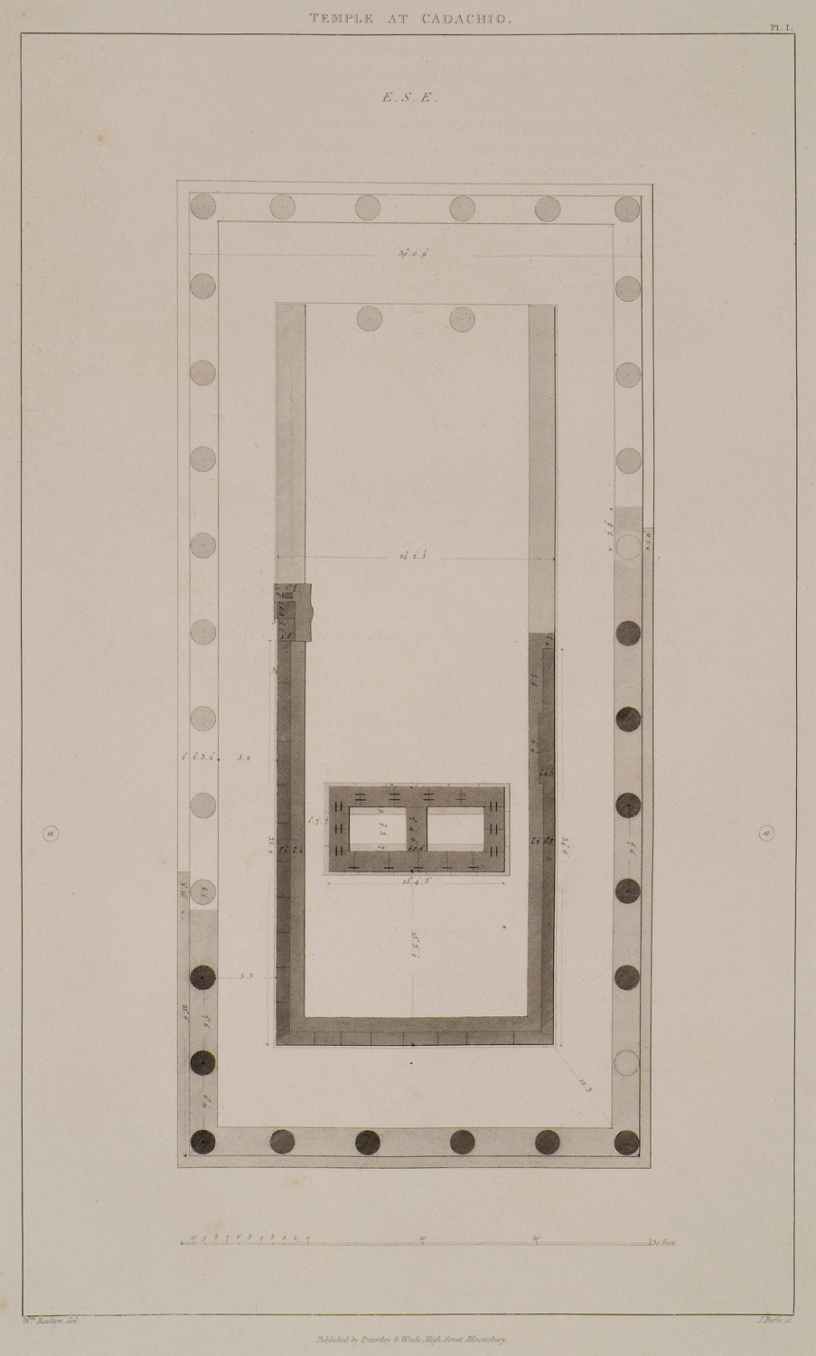
Plan of the Temple of Kardaki, Corfu. A denotes two wells.
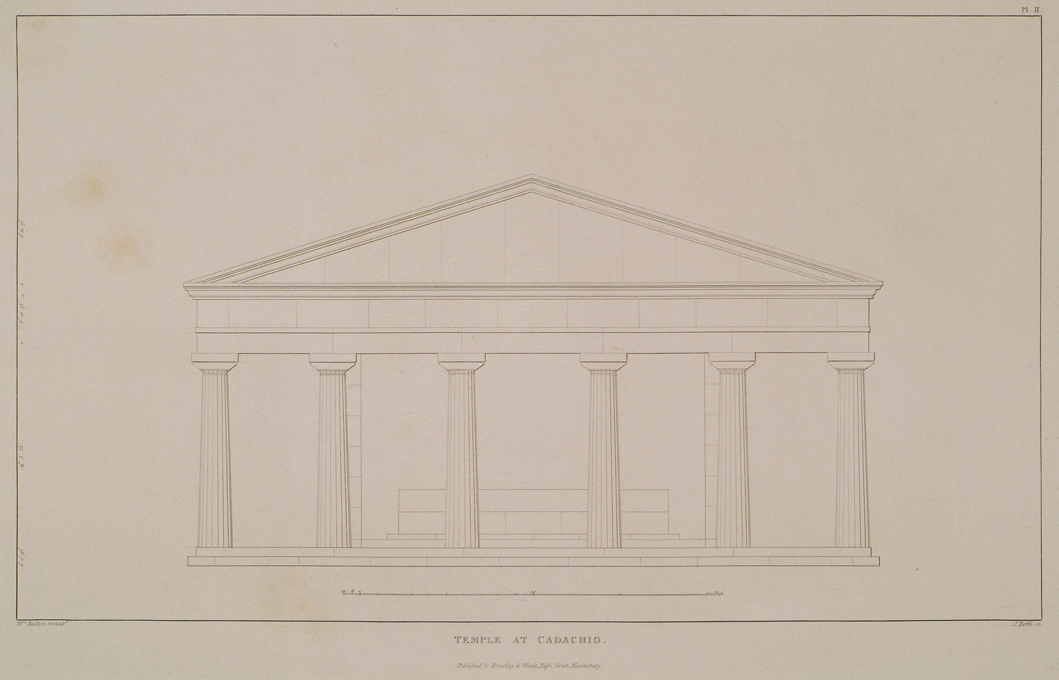
Temple of Kardaki, Corfu: Elevation of the front towards the sea.
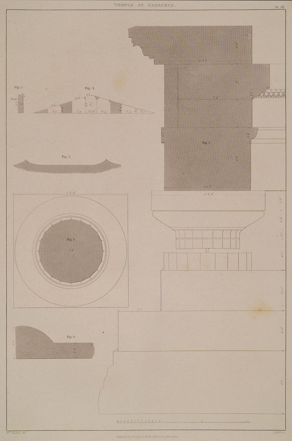
Temple of Kardaki, Corfu. Details of the Order. Fig. 1: Elevation of the capital of the column and a section of the entablature restored from existing fragments, with the exception of the frieze. Fig. 2: Plan of the capital. Fig. 3: Plan of the fluting of the upper diameter, full size. Fig. 4: Shews the construction of the tympanum. Fig. 5: Shews the thickness of the tympanum stones. Fig. 6: Section of the end on one of the terra cotta tiles with which the roof was covered, full size.
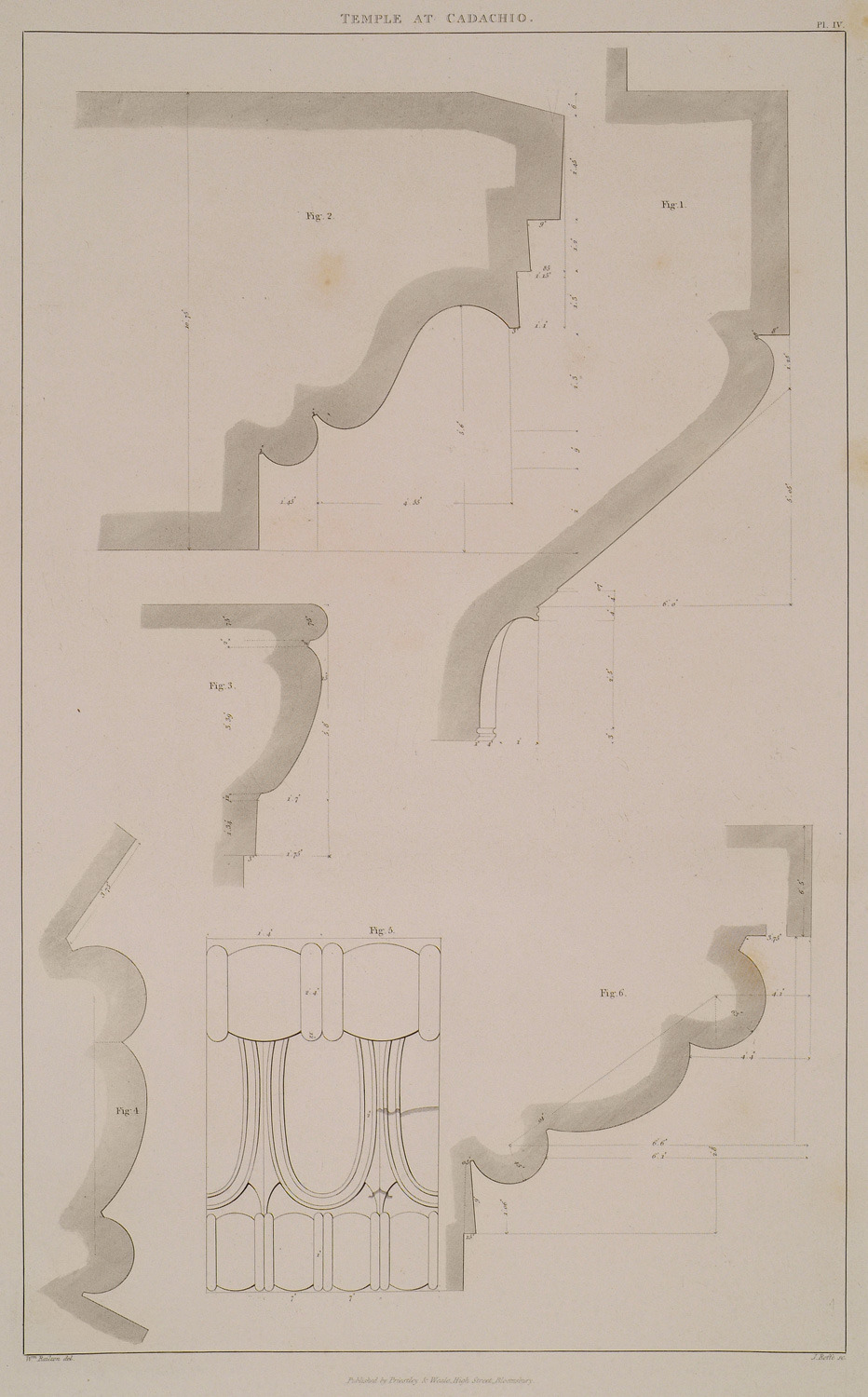
Temple of Kardaki, Corfu: Fig. 1: Section of the capital, half the full size, Fig. 2: Section fo the moulding of the corona, half the full size. Fig, 3: Section of the internal moulding of the architrave, half the full size. Fig. 4 and 5: Elevation and section of an ornament supposed to have been in the frieze of the ambulatory, full size. Fig. 6: Section of the ornament in the true position.
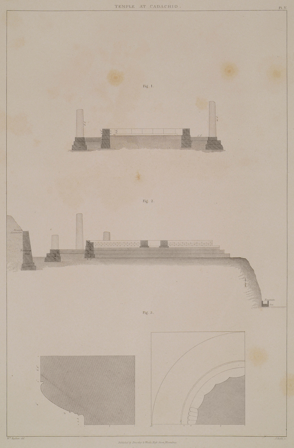
Temple of Kardaki, Corfu: Fig. 1: Transverse section of the temple as it now remains. Fig. 2: Section from east to west. Fig. 3: Section and plan of a Doric capital found in a ruined church within the French lines. It has very much the character of the capital of the pseudodipteral and hexastyle temples at Paestum.
View of Tinos with Chora and Exombourgo.
View of Delos.
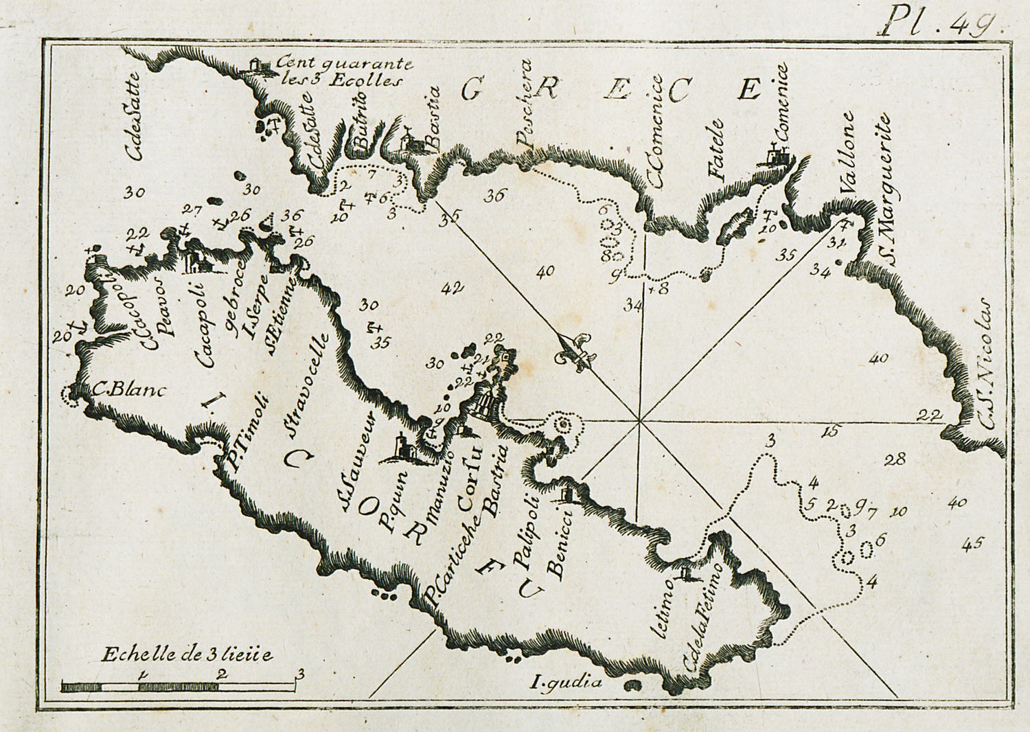
Map of Corfu, charting its eastern coastline and part of Epirus coastline.
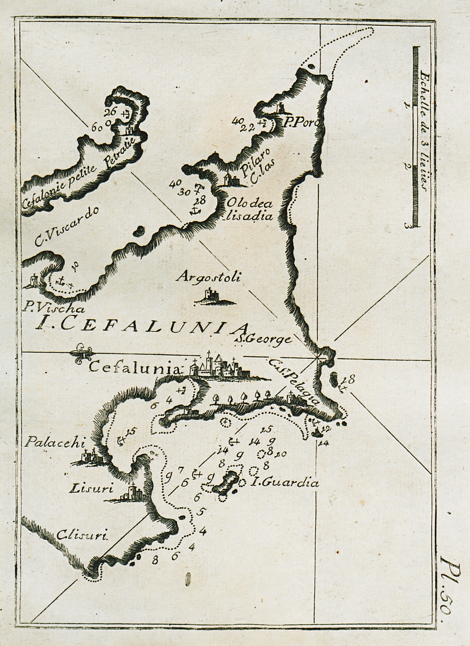
Map of part of Cephalonia, charting the bay and port of Argostoli and surrounding inlets.
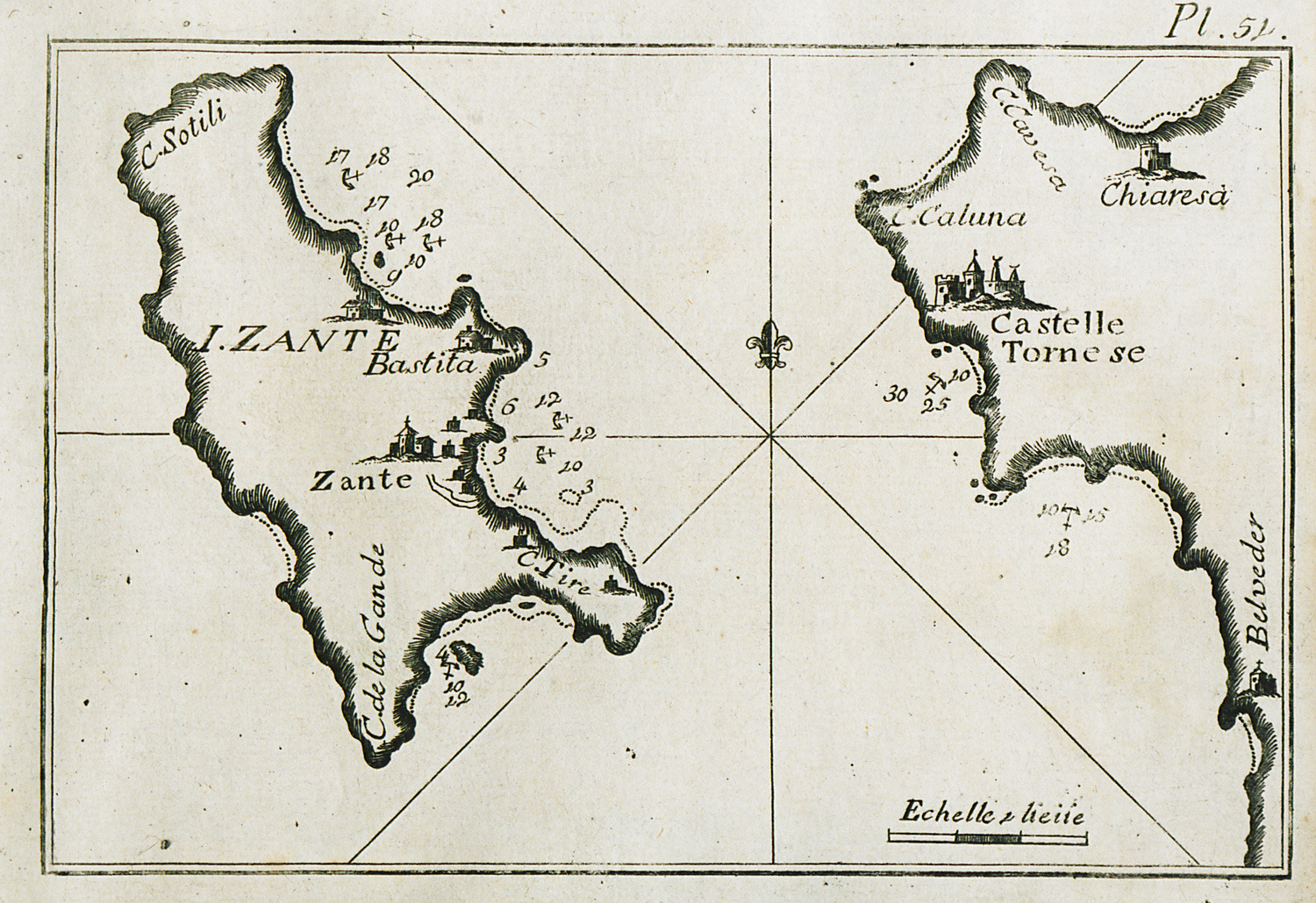
Map of Zakynthos, charting the port waters and eastern inlets of the island.
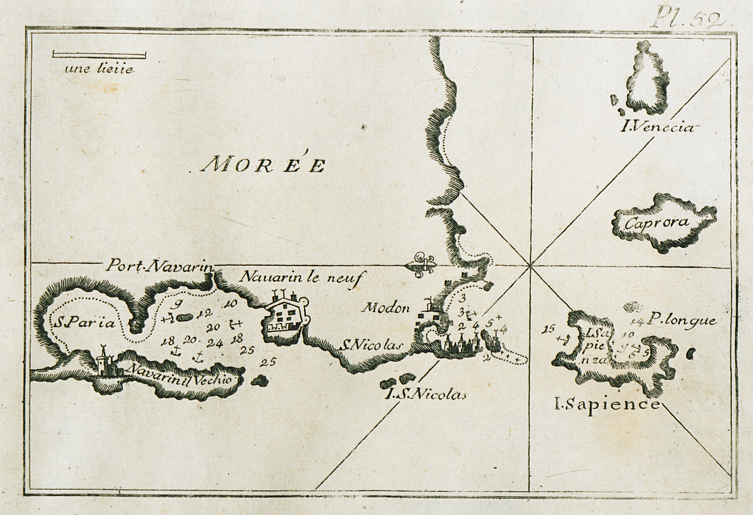
Map of the bay and port of Pylos, of the bay of Methoni and of Sapienza island.
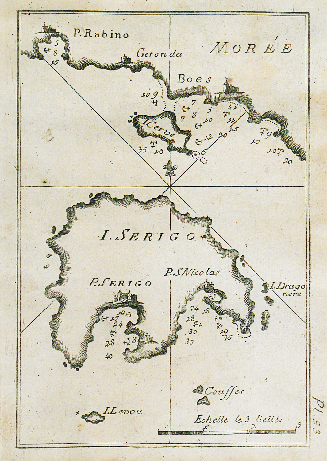
Map of Cythera charting the port waters and the beach of Agios Nicolaos.
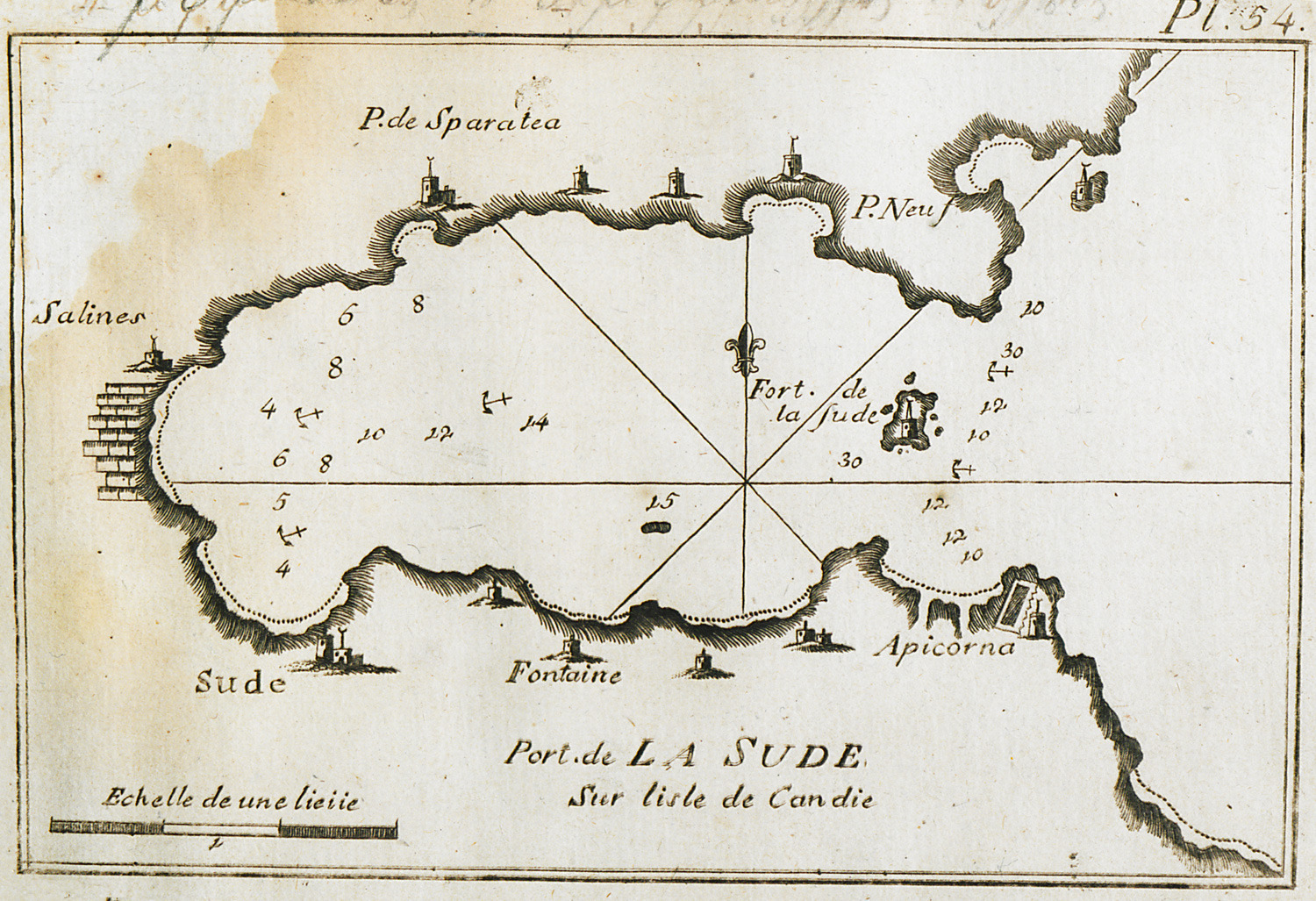
Map of the bay and port of Souda in Crete.
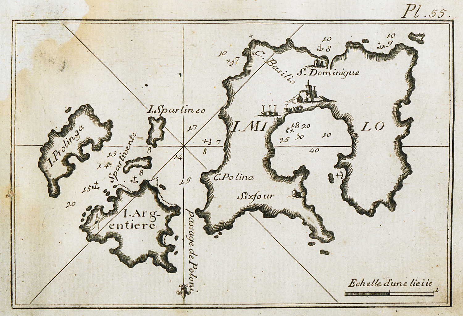
Map of Milos and surrounding islands, charting the port of Milos and the port waters.
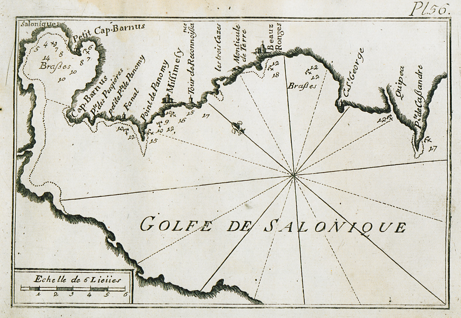
Map of the bay and port of Thessaloniki.
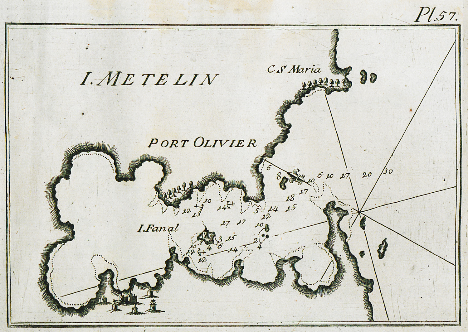
Map of the bay of Geras near Mytilene in Lesbos, partly charting the waters at the gulf entrance.
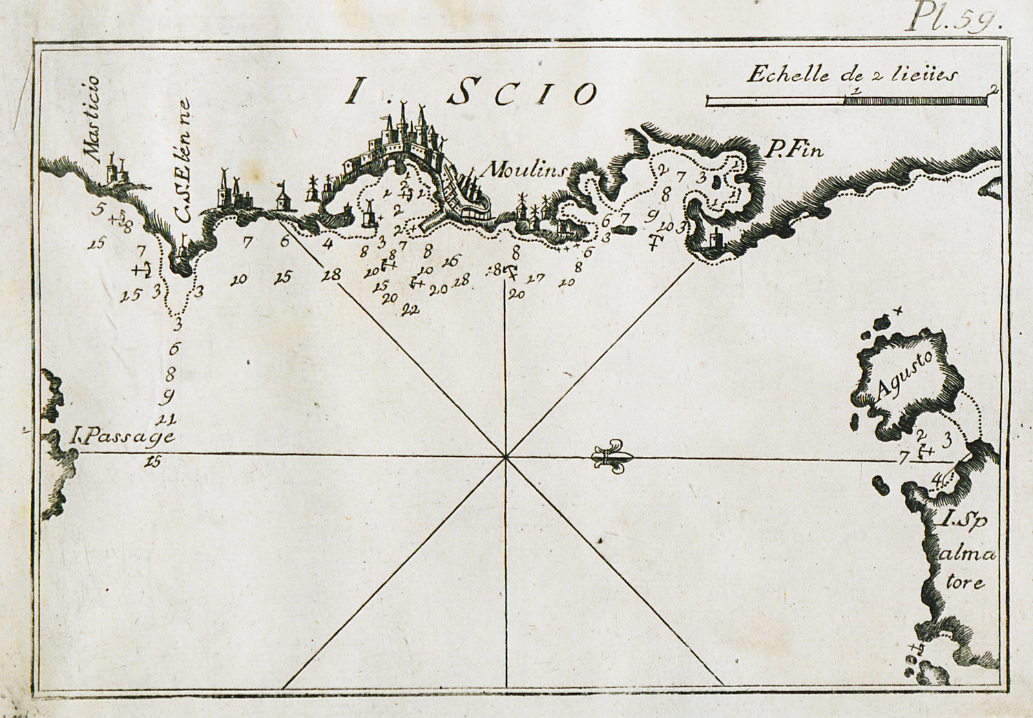
Map of the coastline around the port of Chios.
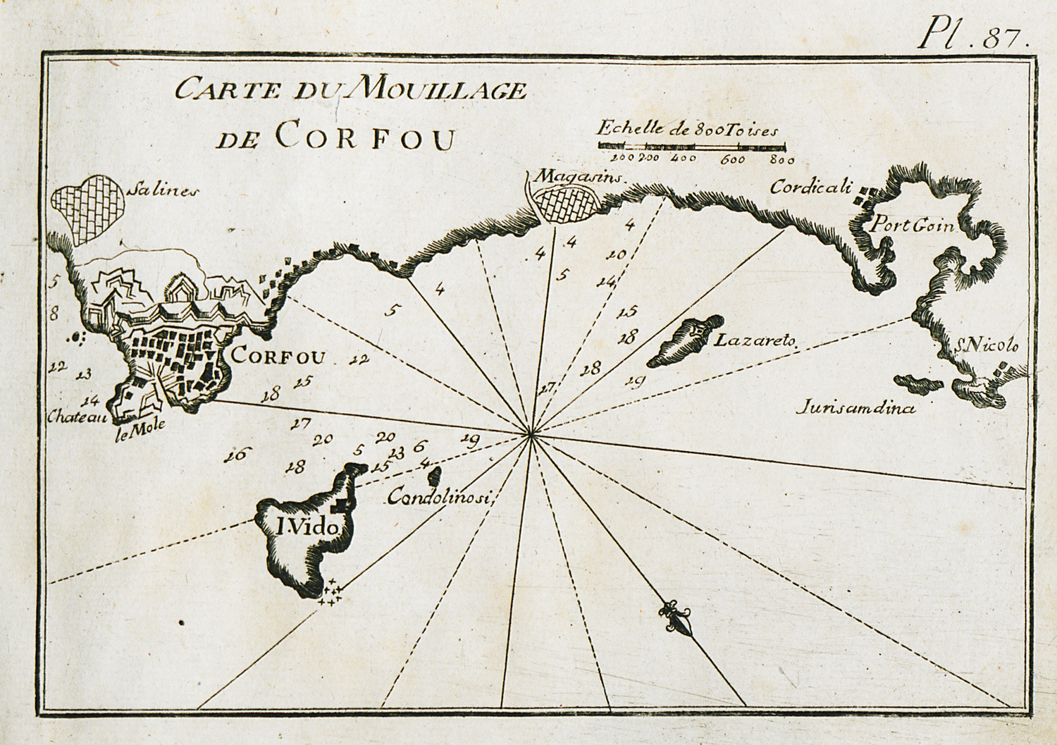
Map of the anchorage of Corfu. View of the city.
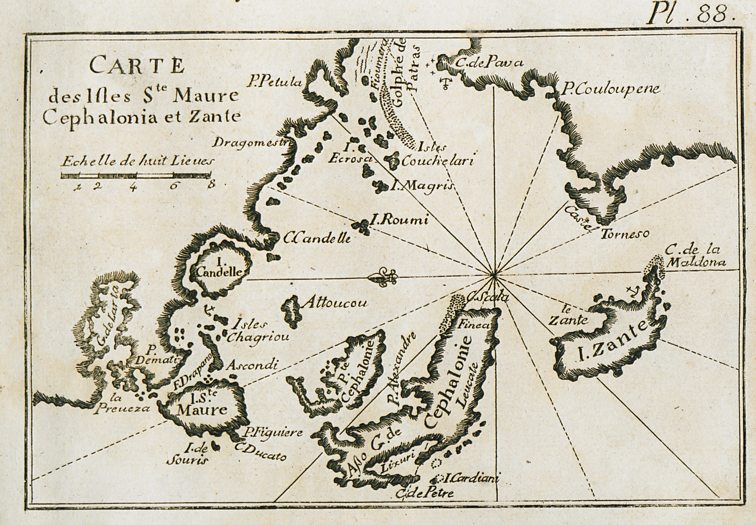
Map of Cephalonia, Zakynthos and Lefkada.
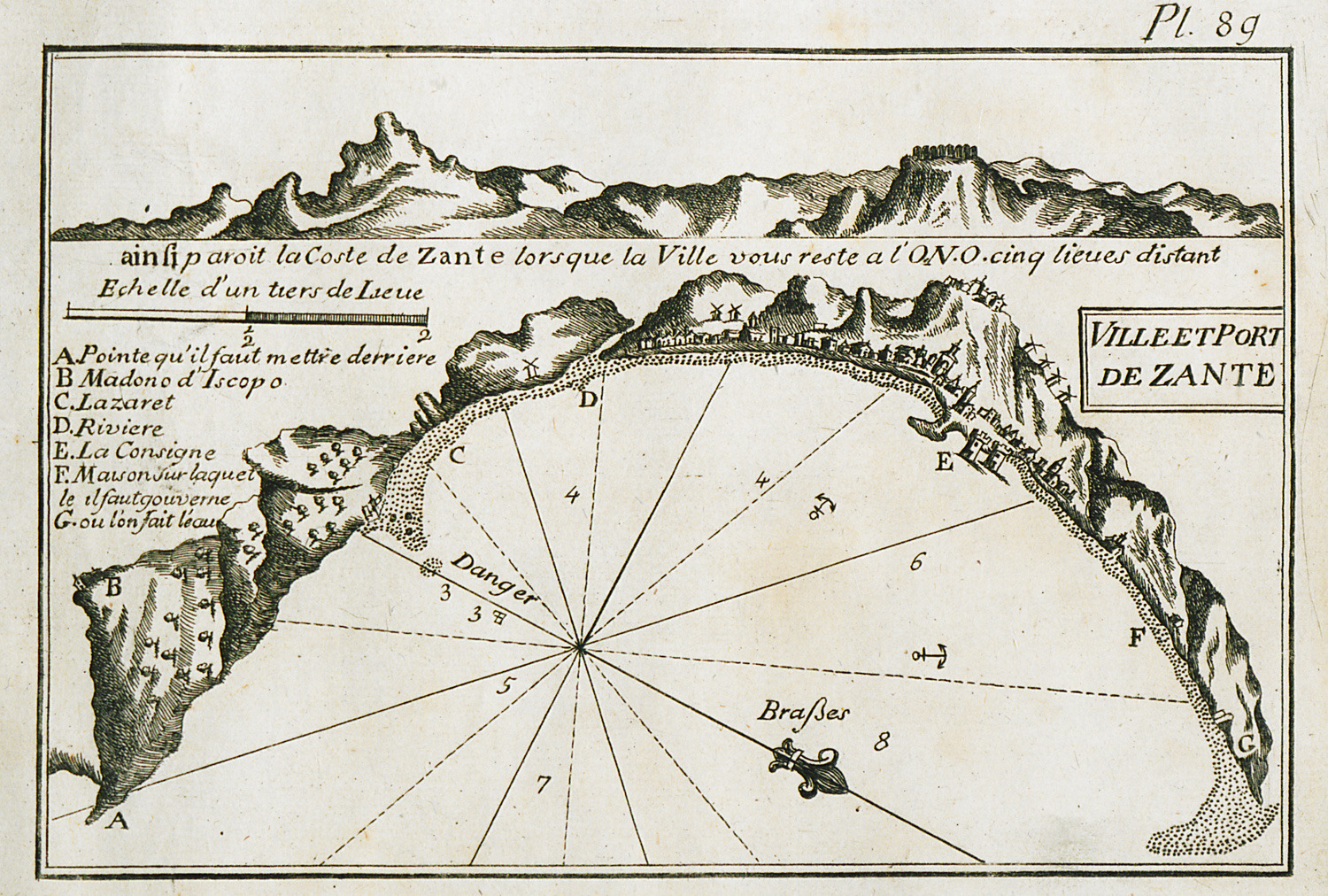
Map of the port of Zakynthos. View of the city.
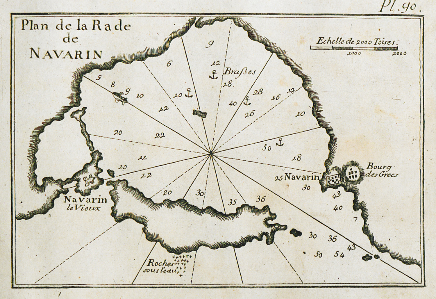
Map of the bay of Pylos (Navarino).
Map of Vatika Bay in the Peloponnese, and of Elaphonisos island.
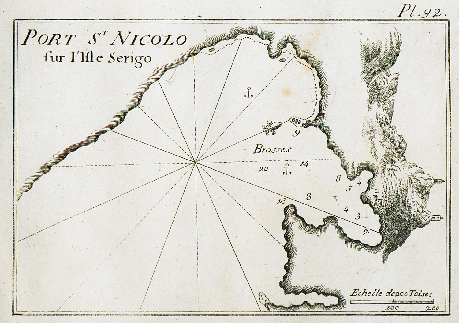
Map of the port of Agios Nicolaos Krassas in Cythera.
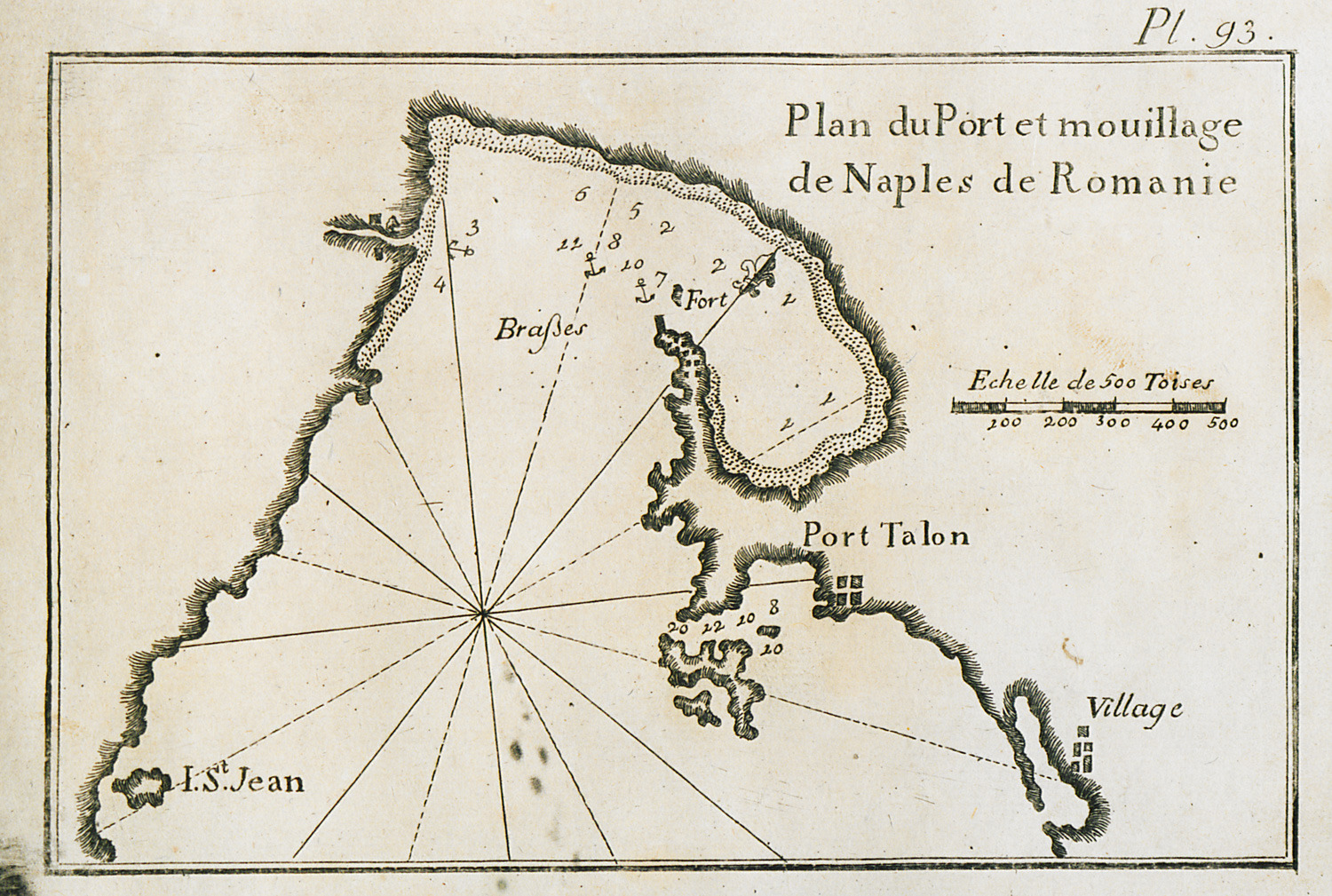
Map of the port and anchorages of Nafplion.
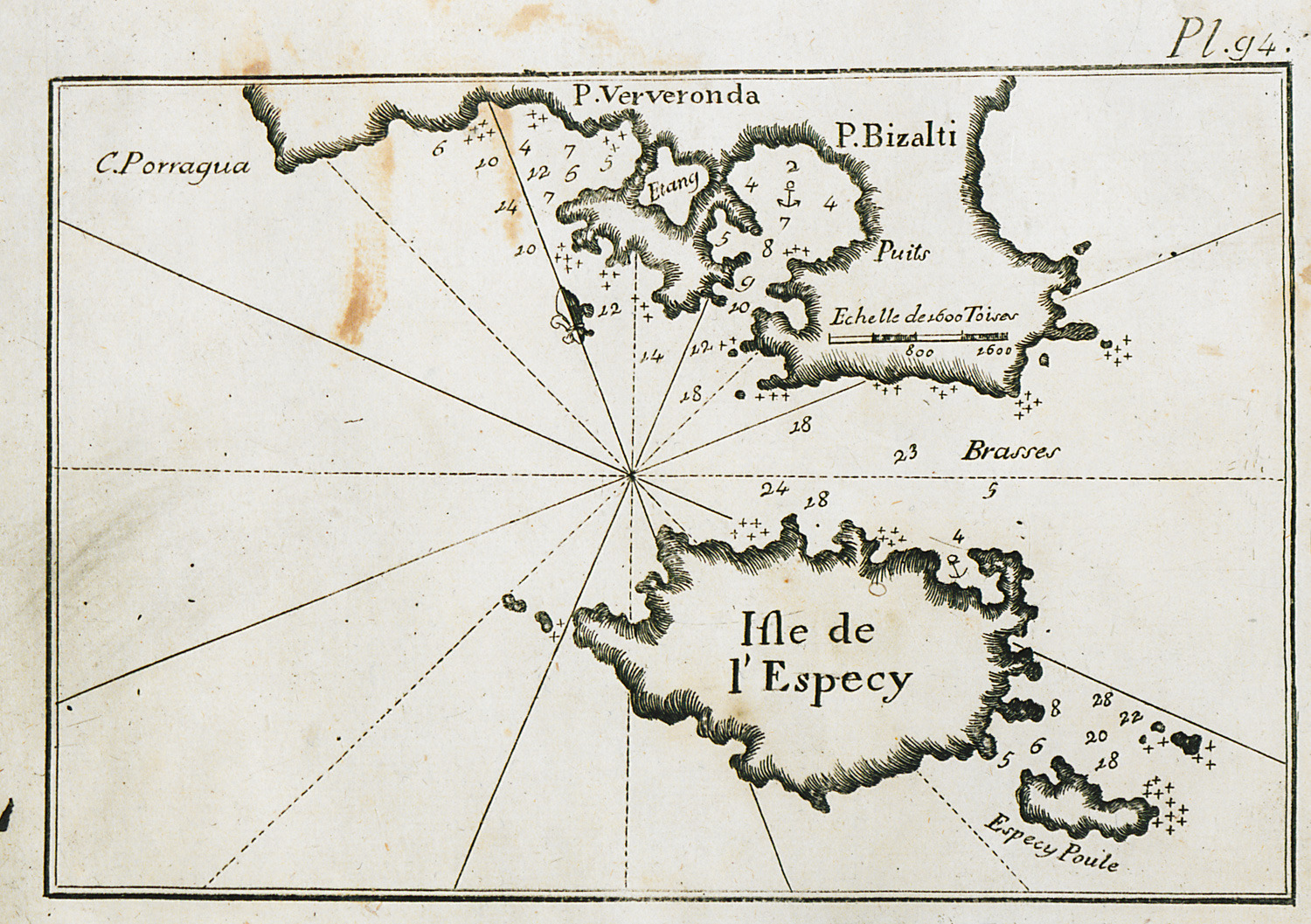
Map of Spetses island, and of the ports of Porto Heli and Ververonta in the Peloponnese.
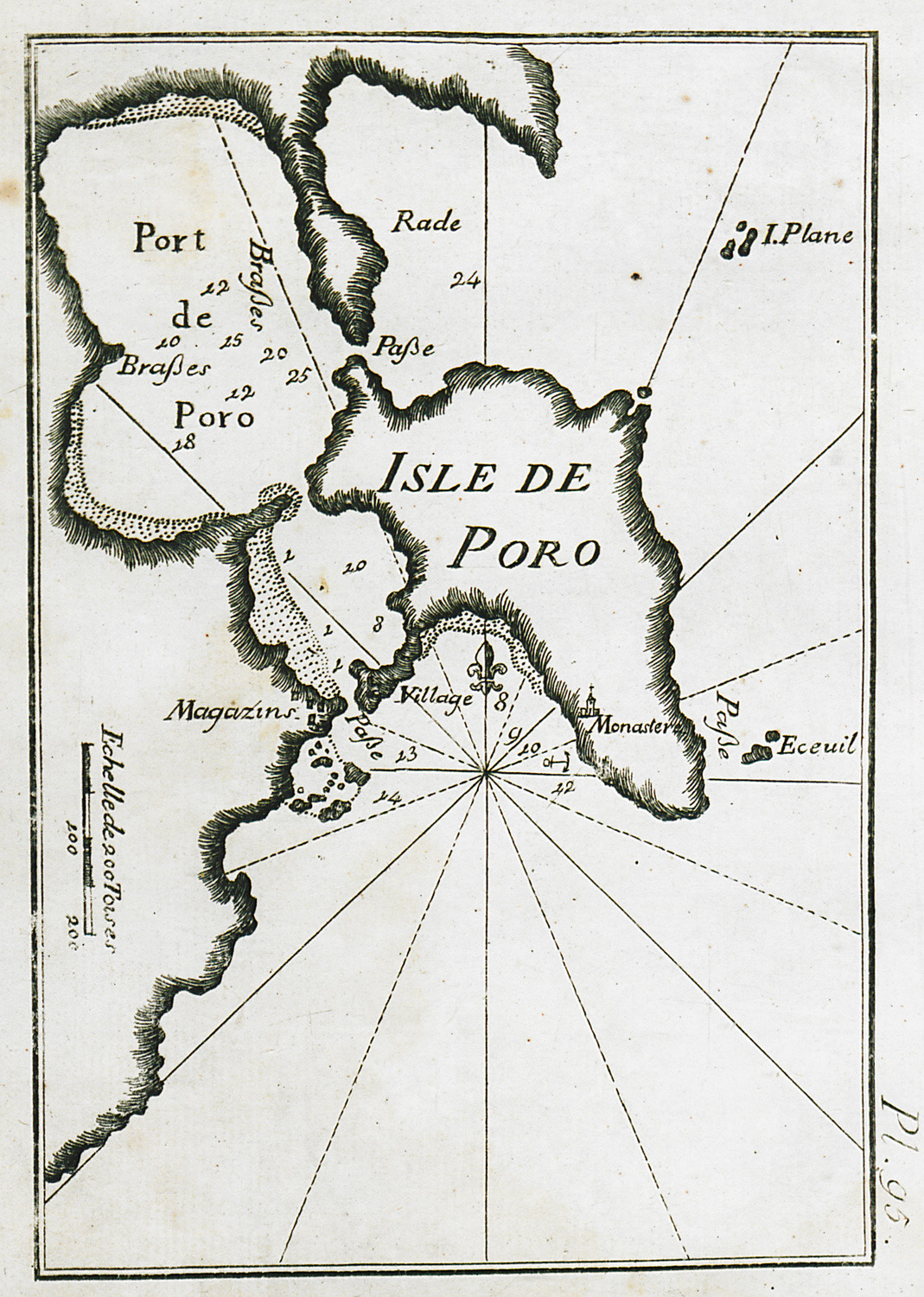
Map of Poros and its port.
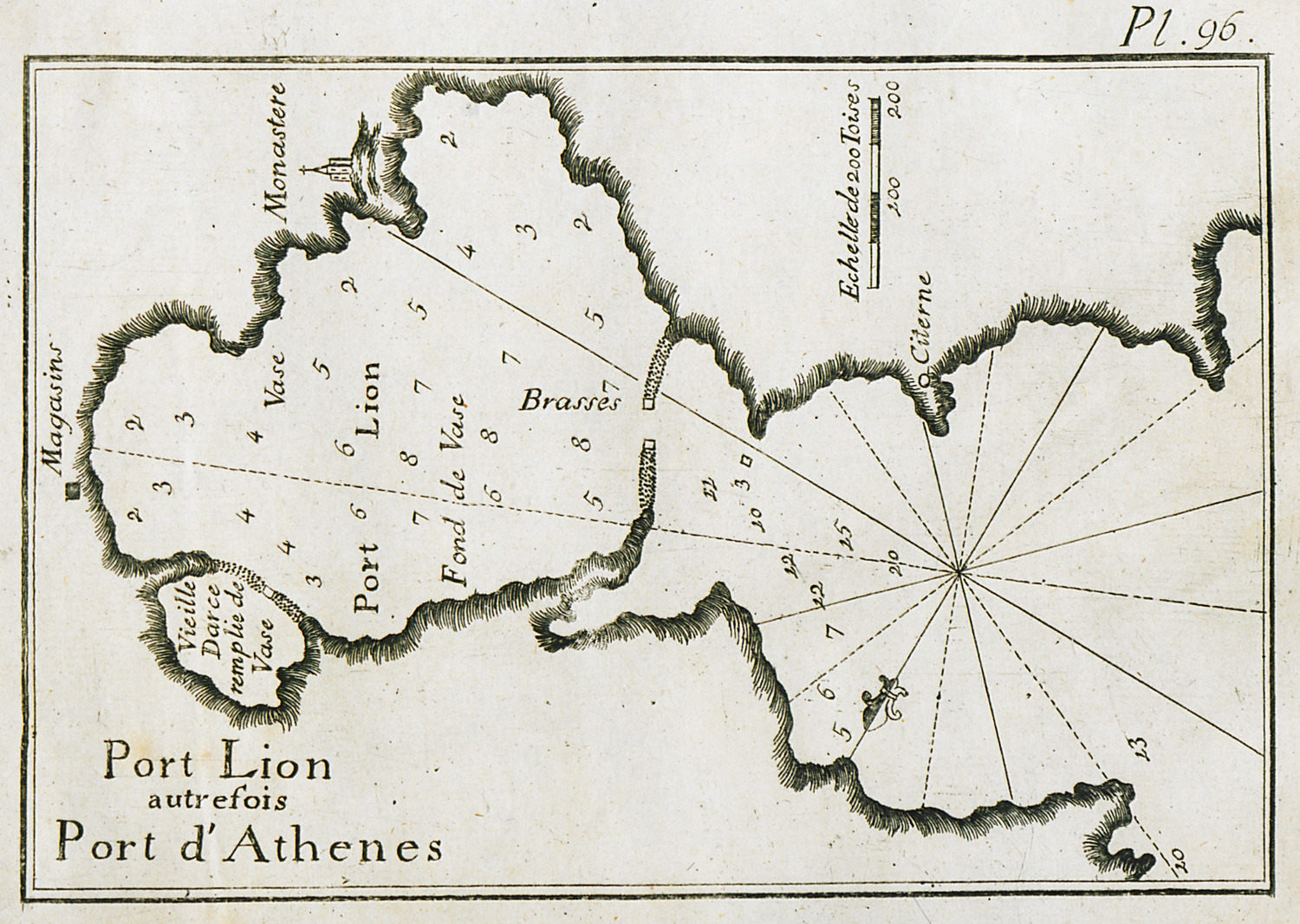
Map of the port of Piraeus.
Map of the port of Thoricus.
Map of the port of Serifos.